Prihradzany: Difference between revisions
Content deleted Content added
infobox, web, commonscat |
Infobox. →References: New Section. Tag: Reverted |
||
| Line 36: | Line 36: | ||
<!-- area --> |
<!-- area --> |
||
| area_footnotes = |
| area_footnotes = |
||
| area_total_km2 = 4.55<ref name="area">{{Cite web |url=http://datacube.statistics.sk/#!/view/sk/VBD_DEM/om7014rr/v_om7014rr_00_00_00_sk |title=Hustota obyvateľstva - obce [om7014rr_ukaz: Rozloha (Štvorcový meter)] |language=sk |date=2021-03-21 |website=www.statistics.sk |publisher= Statistical Office of the Slovak Republic|access-date=2021-11-21}}</ref> |
|||
| area_total_km2 = 4.55 |
|||
| area_total_sq_mi = |
| area_total_sq_mi = 1.76<ref name="area"/> |
||
| area_land_sq_mi = |
| area_land_sq_mi = |
||
| area_water_sq_mi = |
| area_water_sq_mi = |
||
<!-- elevation --> |
<!-- elevation --> |
||
| elevation_footnotes = |
| elevation_footnotes = |
||
| elevation_m = 260<ref name="base_info">{{Cite web |url=http://datacube.statistics.sk/#!/view/sk/VBD_SK_WIN/om5001rr/v_om5001rr_00_00_00_sk |title=Základná charakteristika |language=sk |date=2015-04-17 |website=www.statistics.sk |publisher= Statistical Office of the Slovak Republic|access-date=2021-11-21}}</ref> |
|||
| elevation_m = 260 |
|||
| elevation_ft = |
| elevation_ft = 850<ref name="base_info"/> |
||
| population_as_of = {{abbr|2020|Population: 2020-12-31. Population density & Total area: 2020-06-30/-07-01. Elevation, Postal code & Area code (last updated): 2015-04-17.}} |
|||
<!-- population --> |
|||
| population_as_of = |
|||
| population_footnotes = |
| population_footnotes = |
||
| population_total = 76<ref>{{Cite web |url=http://datacube.statistics.sk/#!/view/sk/VBD_DEM/om7101rr/v_om7101rr_00_00_00_sk |title=Počet obyvateľov podľa pohlavia - obce (ročne) |language=sk |date=2021-03-21 |website=www.statistics.sk |publisher= Statistical Office of the Slovak Republic|access-date=2021-11-21}}</ref> |
|||
| population_total = |
|||
| population_density_km2 = 16.7<ref name="pd">{{Cite web |url=http://datacube.statistics.sk/#!/view/sk/VBD_DEM/om7014rr/v_om7014rr_00_00_00_sk |title=Hustota obyvateľstva - obce |language=sk |date=2021-03-21 |website=www.statistics.sk |publisher= Statistical Office of the Slovak Republic|access-date=2021-11-21}}</ref> |
|||
| population_density_km2 = auto |
|||
| population_density_sq_mi= |
| population_density_sq_mi= 6.4<ref name="pd"/> |
||
| population_demonym = |
| population_demonym = |
||
<!-- time zone(s) --> |
<!-- time zone(s) --> |
||
| Line 58: | Line 57: | ||
<!-- postal codes, area code --> |
<!-- postal codes, area code --> |
||
| postal_code_type = Postal code |
| postal_code_type = Postal code |
||
| postal_code = 049 |
| postal_code = 049 14<ref name="base_info"/> |
||
| area_code_type = |
| area_code_type = |
||
| area_code = 421 |
| area_code = +421 58<ref name="base_info"/> |
||
| geocode = |
| geocode = |
||
| iso_code = |
| iso_code = |
||
| Line 77: | Line 76: | ||
==References== |
==References== |
||
* Gervers-Molnár V. (1972): A középkori Magyarország rotundái. (Romanesque Round Churches of Medieval Hungary.) (Mûvészettörténeti Füzetek, 4.) Akadémiai, Budapest |
* Gervers-Molnár V. (1972): A középkori Magyarország rotundái. (Romanesque Round Churches of Medieval Hungary.) (Mûvészettörténeti Füzetek, 4.) Akadémiai, Budapest |
||
== Rerefences == |
|||
<References/> |
|||
==External links== |
==External links== |
||
Revision as of 12:55, 13 March 2022
Prihradzany | |
|---|---|
Municipality | |
 Lutheran Church in Prihradzany | |
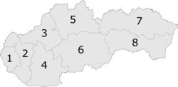
Location of Prihradzany in the Banská Bystrica Region | |
| Coordinates: 48°35′00″N 20°14′20″E / 48.58333°N 20.23889°E | |
| Country | |
| Region | Banská Bystrica |
| District | Revúca |
| First mentioned | 1262 |
| Area | |
| • Total | 4.55[2] km2 (1.76[2] sq mi) |
| Elevation | 260[3] m (850[3] ft) |
| Population (2020) | |
| • Total | 76[1] |
| Time zone | UTC+1 (CET) |
| • Summer (DST) | UTC+2 (CEST) |
| Postal code | 049 14[3] |
| Area code | +421 58[3] |
| Car plate | RA |
| Website | www |
Prihradzany is a village and municipality in Revúca District in the Banská Bystrica Region of Slovakia. Before the First World War it belonged to Hungary for 1000 years. Its name is Kisperlász in Hungarian

Sightseeing
In the cemetery stands the old rotunda named St. Anna. It had been built in the 11th-12th century in the Árpád age. Its diameter is 9 meters.
References
- Gervers-Molnár V. (1972): A középkori Magyarország rotundái. (Romanesque Round Churches of Medieval Hungary.) (Mûvészettörténeti Füzetek, 4.) Akadémiai, Budapest
Rerefences
- ^ "Počet obyvateľov podľa pohlavia - obce (ročne)". www.statistics.sk (in Slovak). Statistical Office of the Slovak Republic. 2021-03-21. Retrieved 2021-11-21.
- ^ a b "Hustota obyvateľstva - obce [om7014rr_ukaz: Rozloha (Štvorcový meter)]". www.statistics.sk (in Slovak). Statistical Office of the Slovak Republic. 2021-03-21. Retrieved 2021-11-21.
- ^ a b c d "Základná charakteristika". www.statistics.sk (in Slovak). Statistical Office of the Slovak Republic. 2015-04-17. Retrieved 2021-11-21.
- ^ a b "Hustota obyvateľstva - obce". www.statistics.sk (in Slovak). Statistical Office of the Slovak Republic. 2021-03-21. Retrieved 2021-11-21.
External links
 Media related to Prihradzany at Wikimedia Commons
- Official website

- http://www.statistics.sk/mosmis/eng/run.html
- Information homepage of the village Prihradzany (Kisperlász)
- Prihradzany (Kisperlász) in Slovakia Map
- Prihradzany (Kisperlász) as site for pilgrimage
- Barna Gábor stufies in Journal Néprajzi Látóhatár (in Hungarian).
- Erdélyi G.: Gömör vármegye klasszicista építészete (Classicist architecture in Gömör County).


