Rakůvka: Difference between revisions
Content deleted Content added
population, infobox |
population |
||
| (One intermediate revision by the same user not shown) | |||
| Line 3: | Line 3: | ||
| other_name = |
| other_name = |
||
| settlement_type = [[Obec|Municipality]] |
| settlement_type = [[Obec|Municipality]] |
||
<!-- images |
<!-- images --> |
||
| image_skyline = |
| image_skyline = Kaple Nanebevzetí Panny Marie, Rakůvka, okres Prostějov (06).jpg |
||
| image_caption = Centre of Rakůvka |
| image_caption = Centre of Rakůvka |
||
| image_flag = Rakůvka flag.gif |
| image_flag = Rakůvka flag.gif |
||
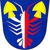
| image_shield = Rakůvka CoA.jpg |
| image_shield = Rakůvka CoA.jpg |
||
| Line 36: | Line 36: | ||
| elevation_m = 434 |
| elevation_m = 434 |
||
<!-- population --> |
<!-- population --> |
||
| population_as_of = |
| population_as_of = 2023-01-01 |
||
| population_footnotes = <ref>{{cite web |title=Population of Municipalities – 1 January |
| population_footnotes = <ref>{{cite web |title=Population of Municipalities – 1 January 2023|url=https://www.czso.cz/csu/czso/population-of-municipalities-1-january-2023|publisher=[[Czech Statistical Office]]|date=2023-05-23}}</ref> |
||
| population_total = |
| population_total = 105 |
||
| population_density_km2 = auto |
| population_density_km2 = auto |
||
<!-- time zone(s) --> |
<!-- time zone(s) --> |
||
Revision as of 06:27, 20 June 2023
Rakůvka | |
|---|---|
 Centre of Rakůvka | |
| Coordinates: 49°36′35″N 16°56′15″E / 49.60972°N 16.93750°E | |
| Country | |
| Region | Olomouc |
| District | Prostějov |
| First mentioned | 1371 |
| Area | |
| • Total | 2.89 km2 (1.12 sq mi) |
| Elevation | 434 m (1,424 ft) |
| Population (2023-01-01)[1] | |
| • Total | 105 |
| • Density | 36/km2 (94/sq mi) |
| Time zone | UTC+1 (CET) |
| • Summer (DST) | UTC+2 (CEST) |
| Postal code | 798 57 |
| Website | www |
Rakůvka is a municipality and village in Prostějov District in the Olomouc Region of the Czech Republic. It has about 100 inhabitants.
Rakůvka lies approximately 20 kilometres (12 mi) north-west of Prostějov, 23 km (14 mi) west of Olomouc, and 189 km (117 mi) east of Prague.
References
Wikimedia Commons has media related to Rakůvka.


