Bousin
| Bousin | ||||
|---|---|---|---|---|
|
||||
| Basic data | ||||
| State : |
|
|||
| Region : | Olomoucký kraj | |||
| District : | Prostějov | |||
| Area : | 341 ha | |||
| Geographic location : | 49 ° 27 ' N , 16 ° 54' E | |||
| Height: | 611 m nm | |||
| Residents : | 134 (Jan 1, 2019) | |||
| Postal code : | 798 61 | |||
| structure | ||||
| Status: | local community | |||
| Districts: | 2 | |||
| administration | ||||
| Mayor : | Monika Tmé (as of 2020) | |||
| Address: | Bousín 47 798 61 Drahany |
|||
| Municipality number: | 589306 | |||
| Website : | www.bousin.cz | |||
Bousín is a municipality in Okres Prostějov , Olomoucký kraj region , Czech Republic .
history
The first written mention can be traced back to 1373. The origin of the name Bousín is assigned to the name bearer of the founder, Bohuš z Jedovnic.
In the course of the construction of the German military training area Wischau , Bousín was one of the 33 places to be cleared. The evacuation of the third stage village began in October 1943. After the end of the Second World War, the place was repopulated.
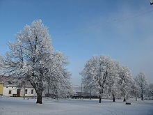
In the village square there is a bell tower from 1794. There is a regular bus service to Prostějov twice a day .
The village is surrounded by forests. There is a general store and an inn in Bousín. Some of the historic houses are used as holiday homes.
Web links
Community structure
The municipality of Bousín consists of the districts Bousín and Repechy .


