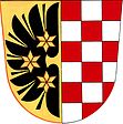
Brodek u Prostějova
| Brodek u Prostějova | ||||
|---|---|---|---|---|
|
||||
| Basic data | ||||
| State : |
|
|||
| Region : | Olomoucký kraj | |||
| District : | Prostějov | |||
| Area : | 611 ha | |||
| Geographic location : | 49 ° 22 ' N , 17 ° 5' E | |||
| Height: | 260 m nm | |||
| Residents : | 1,518 (Jan 1, 2019) | |||
| Postal code : | 798 07 | |||
| structure | ||||
| Status: | Městys | |||
| Districts: | 2 | |||
| administration | ||||
| Mayor : | Radek Rozmánek (as of 2012) | |||
| Address: | Císařská 39 798 07 Brodek u Prostějova |
|||
| Municipality number: | 589322 | |||
| Website : | www.brodek.cz | |||
Brodek u Prostějova , until 1948 Brodek (German Prödlitz ) is a minority in the Czech Republic and belongs to the Okres Prostějov .
geography
The place extends over 6.11 km² and has 1529 inhabitants (as of January 1, 2014). Brodek is about 12 km south of Prostějov and 28 km southwest of Olomouc , 208 km southeast of the Czech capital Prague .
Community structure
Brodek u Prostějova consists of the districts Brodek u Prostějova and Sněhotice.
Web links
Commons : Brodek u Prostějova - collection of pictures, videos and audio files


