Niva
| Niva | ||||
|---|---|---|---|---|
|
||||
| Basic data | ||||
| State : |
|
|||
| Region : | Olomoucký kraj | |||
| District : | Prostějov | |||
| Area : | 1340 ha | |||
| Geographic location : | 49 ° 27 ' N , 16 ° 51' E | |||
| Height: | 556 m nm | |||
| Residents : | 333 (Jan. 1, 2019) | |||
| Postal code : | 798 61 | |||
| traffic | ||||
| Street: | Prostějov - Rájec-Jestřebí | |||
| structure | ||||
| Status: | local community | |||
| Districts: | 1 | |||
| administration | ||||
| Mayor : | Marta Servusová (as of 2015) | |||
| Address: | Niva 61 798 61 Drahany |
|||
| Municipality number: | 589772 | |||
| Website : | www.obecniva.cz | |||
Niva , until 1949 Hartmanice , (German Hartmanitz ) is a municipality in the Czech Republic . It is located 15 kilometers southeast of Boskovice and belongs to the Okres Prostějov .
geography
Niva is located in the valley of the Bílá voda brook in the Drahaner Bergland . Neighboring towns are Protivanov in the north, Repechy in the northeast, Bousín and Drahany in the east, Otinoves in the southeast, Rozstání in the south, Baldovec in the southwest, Molenburk in the west and Obora and Skelná Huť in the northwest.
history
Hartmanice was first mentioned in 1347. At that time, a part of the village belonged to the Plumlov rule and thus to the possession of Beneš von Krawarn . The next owners of Hartmanice were the Pernsteiners , who pledged the place to Bernard Krnovský von Drnovin in 1592. In 1618 Maximilian von Liechtenstein bought the place, which remained part of the Liechtenstein rule of Plumlov until the abolition of patrimonial rule in 1848.
In the course of the construction of the German military training area Wischau , Hartmanitz was one of the 33 places to be cleared for it. The evacuation of the village belonging to the 2nd stage began on November 30, 1942. After the end of the Second World War, the place was repopulated. In 1949 the Hartmanice parish was renamed Niva . The new name is derived from the blue cheese Niva , which has been produced in the Drahaner Bergland since the 1920s and which is still made in the dairy in the neighboring village of Otinoves. Niva has had a coat of arms and a banner since 2003.
Local division
No districts are shown for the municipality of Niva.
Attractions
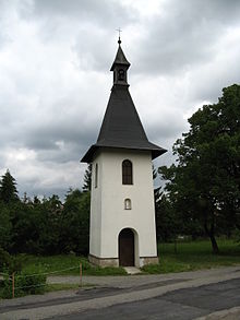
- Bell tower
- Niche chapel on the street
Individual evidence
- ↑ Český statistický úřad - The population of the Czech municipalities as of January 1, 2019 (PDF; 7.4 MiB)
- ↑ In the course of 1949, places in Czechoslovakia were renamed ( memento of the original from February 10, 2008 in the Internet Archive ) Info: The archive link was inserted automatically and has not yet been checked. Please check the original and archive link according to the instructions and then remove this notice.
- ↑ http://www.mot.cz/o-mlekarne/


