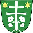
Vysočany u Blanska
| Vysočany | ||||
|---|---|---|---|---|
|
||||
| Basic data | ||||
| State : |
|
|||
| Region : | Jihomoravský kraj | |||
| District : | Blansko | |||
| Area : | 1212 ha | |||
| Geographic location : | 49 ° 26 ' N , 16 ° 48' E | |||
| Height: | 580 m nm | |||
| Residents : | 790 (Jan. 1, 2019) | |||
| Postal code : | 679 13 | |||
| License plate : | B. | |||
| traffic | ||||
| Street: | Prostějov - Rájec-Jestřebí | |||
| structure | ||||
| Status: | local community | |||
| Districts: | 2 | |||
| administration | ||||
| Mayor : | Josef Ovad (as of 2018) | |||
| Address: | Molenburk 130 679 13 Sloup v Moravském Krasu |
|||
| Municipality number: | 582701 | |||
| Website : | www.vysocany.com | |||
Vysočany is a municipality in the Czech Republic . It is located twelve kilometers southeast of Boskovice and belongs to the Okres Blansko . It was created in 1964 through the merger of the municipalities of Housko and Molenburk.
geography
Vysočany is located on a plateau northeast of the Moravian Karst in the Drahan Mountains . To the northwest lies the valley of the Punkva , to the south that of the Bíla voda. The Obecní rybník pond is located in the center of the village.
Neighboring towns are Obora and Skelná Huť in the north, Protivanov in the northeast, Niva in the east, Otinoves in the southeast, Baldovec in the south, Holštejn and Šošůvka in the southwest, Němčice in the west and Ludíkov and Žďárná in the northwest.
history
Housko / Hausko
The first documentary mention of the village Hartwigslag took place in 1349 with the land table entry of the sale of the Holštejn castle to Wok / Vok, which took place before 1321 , who came from the Moravian dynasty of the Hrut and founded the independent tribe of the Lords of Holstein . In 1437 the place was called Husí and at the same time the Church of the Virgin Mary was first named. However, the village was not located where it is today, but two kilometers north on the Punkva. In the second half of the 15th century the village was destroyed. In 1493 Housko was burned down and in 1564 it was described as desolate. Not far from today's Molenburk was the village of Bohdalevsko, which was mentioned for the last time in 1587 and then fell desolate.
In 1760 Housko was rebuilt in a new place when several houses were built around a glassworks. In 1793 Housko consisted of 20 houses and had 129 inhabitants. In 1921 the number of houses had increased to 47 and 317 people lived in the village.
In the course of the construction of the German military training area Wischau , Hausko was one of the 33 places to be cleared for it. The evacuation of the 3rd stage village took place by October 30, 1944. After the end of the Second World War, the place was repopulated. In 1964 Housko was united with Molenburk to form the municipality of Vysočany. In 1991 the district of Housko had 224 inhabitants.
Molenburk / Mollenburg
The village of Mollenburg was founded in 1724 by the owner of the Raitz estate , Karl Ludwig von Roggendorf and Mollenburg . In 1760 a glassworks was built west of the village, around which a settlement was created. This got the name of the desert village Housko. In 1763 Anton Josef Altgraf von Salm-Reifferscheidt acquired the Raitz rule from the heirs Caroline von Roggendorf, née Pálffy- Erdöd, the widow of Karl Ludwig. In 1793 Mollenburg consisted of 32 houses in which 230 people lived. Hugo zu Altgraf Salm-Reifferscheidt had a one-class village school set up in Mollenburg in 1817. After the patrimonial rule was replaced in 1848, Mollenburg became an independent municipality, which from 1850 belonged to the Blansko district . In 1869 Mollenburg came to the Boskowitz district . The church was built between 1870 and 1873. In 1874 Mollenburg, which until then belonged to the parish in Protivanov, was re-parish to Sloup . In 1900 the community had 550 inhabitants and consisted of 81 houses.
In the course of the construction of the German military training area Wischau , Mollenburg was one of the 33 places to be cleared for this purpose. The evacuation of the third stage village took place by December 31, 1944. After the end of the Second World War, the place was settled again. The goods were owned by the Salm-Reifferscheidt-Raitz family until they were expropriated after the Second World War. Since 1950 the place belongs to the Okres Blansko. In 1964, Molenburk was united with Housko to form the municipality of Vysočany.
Local division
The municipality Vysočany consists of the districts Housko ( Hausko ) and Molenburk ( Mollenburg ), which also form cadastral districts.
Attractions
- Church of St. Cyril and Methodius, consecrated in 1873
Web links
Individual evidence
- ↑ http://www.uir.cz/obec/582701/Vysocany
- ↑ Český statistický úřad - The population of the Czech municipalities as of January 1, 2019 (PDF; 7.4 MiB)
- ↑ According to recent historical research, the descent of the Lords of Holštejn from the Lords of Sovinec is doubted or rejected. See David Papajík: Páni z Holštejna , České Budějovice 2007, ISBN 978-80-86829-24-1 and cs: Vok I. z Holštejna and cs: Páni z Holštejna .
- ↑ http://www.uir.cz/casti-obce-obec/582701/Obec-Vysocany
- ↑ http://www.uir.cz/katastralni-uzemi-obec/582701/Obec-Vysocany

