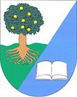
Jabloňany
| Jabloňany | ||||
|---|---|---|---|---|
|
||||
| Basic data | ||||
| State : |
|
|||
| Region : | Jihomoravský kraj | |||
| District : | Blansko | |||
| Area : | 241 ha | |||
| Geographic location : | 49 ° 28 ' N , 16 ° 36' E | |||
| Height: | 337 m nm | |||
| Residents : | 390 (Jan. 1, 2019) | |||
| Postal code : | 679 01 | |||
| License plate : | B. | |||
| traffic | ||||
| Street: | Skalice nad Svitavou - Obora | |||
| structure | ||||
| Status: | local community | |||
| Districts: | 1 | |||
| administration | ||||
| Mayor : | Roman Plch (as of 2018) | |||
| Address: | Jabloňany 88 679 01 Skalice nad Svitavou |
|||
| Municipality number: | 581666 | |||
| Website : | www.jablonany.cz | |||
Jabloňany (German Jablonian ) is a municipality in the Czech Republic . It is located five kilometers southwest of Boskovice and belongs to the Okres Blansko .
geography
Jabloňany is located at the western foot of the Drahaner Bergland in the Boskowitz furrow . The village extends on the right side over the valley of the Svitava up to the brook Úmoří. To the northeast rises the Faberka (445 m), behind it the Bělá flows into the Svitava. To the southwest lie the hills Na Kamencích (428 m) and Malý Chlum (488 m). The road I / 43 / E 461 passes to the west of the village , behind it are the embankments of the unfinished Vienna-Wroclaw Reichsautobahn .
Neighboring towns are Skalice nad Svitavou and Mladkov in the north, Boskovice and Pilský Dvůr in the northeast, Lhota Rapotina in the east, Kuničky and Doubravice nad Svitavou in the southeast, Obora in the south, Perná in the southwest, Krhov and Drnovice in the west and Voděrady and Sebranice in the northwest.
history
Archaeological finds show an early settlement of the municipality. The favorable location above two valleys and ore deposits contributed to this. There used to be an ironworks at the mouth of the Úmoří and Svitava. The village was first mentioned in a document in 1357 in the land table in connection with Vladiken Jaroš von Jabloňany and his wife Kačna. In 1361 Radon von Radslavice signed half of the village over to his wife Katharina. At the same time, he satisfied Albert von Svárov, who had sued against this detrimental personal asset, with 100 Prague groschen . Later the village was attached to the Černá Hora estate . In 1831 35 people died of cholera . In 1843 the Niederdorf was hit by a flood of the Úmoří. The parish has always been Doubravice nad Svitavou.
After the abolition of patrimonial Jabloňany formed from 1850 a municipality in the district administration Boskovice . A primary school was built between 1852 and 1853. This was later moved to house number 37 after differences with the clergy. In 1878 the cherry orchards were laid out. In 1903 a major fire destroyed eight houses in the village. In 1907 the volunteer fire brigade was founded. Finally, between 1909 and 1910, a new, larger school building was built. After the dissolution of Okres Boskovice, the municipality came to Okres Blansko at the beginning of 1961 . The Horní Úmoří mill was dismantled in 1976. 1980 Jabloňany was incorporated together with Krhov to Skalice nad Svitavou . Jabloňany has existed again since 1990. Jabloňany has had a coat of arms and a banner since 2001. Today in Jabloňany primary school is given to children aged 1–5. Class given. Further education takes place in Boskovice.
Community structure
No districts are shown for the Jabloňany community.
Attractions
- Chapel of St. Kyrill und Method, built from 1893 to 1895 instead of a wooden bell tower, it was renovated in 1993
- Baroque statue of St. John of Nepomuk, created around 1750
- Malý Chlum with a 10 m high observation tower, south of the village
- Sandstone sculptures by Stanislav Rolínek on Malý and Velký Chlum


