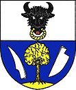
Černovice u Kunštátu
| Černovice | ||||
|---|---|---|---|---|
|
||||
| Basic data | ||||
| State : |
|
|||
| Region : | Jihomoravský kraj | |||
| District : | Blansko | |||
| Area : | 1318 ha | |||
| Geographic location : | 49 ° 29 ' N , 16 ° 25' E | |||
| Height: | 624 m nm | |||
| Residents : | 377 (Jan 1, 2019) | |||
| Postal code : | 679 75 | |||
| License plate : | B. | |||
| traffic | ||||
| Street: | Lysice - Hodonín | |||
| structure | ||||
| Status: | local community | |||
| Districts: | 1 | |||
| administration | ||||
| Mayor : | Jaroslav Zhoř (as of 2018) | |||
| Address: | Černovice 113 679 75 Černovice |
|||
| Municipality number: | 581500 | |||
| Website : | obeccernovice.cz | |||
Černovice (German Tschernowitz , formerly Chernivtsi ) is a municipality in the Czech Republic . It is located eight kilometers southwest of Kunštát and belongs to the Okres Blansko .
geography
Černovice is located in the Sýkořská pahorkatina, a subunit of the Nedvědická vrchovina in the Bohemian-Moravian Highlands . The village is located on the upper reaches of the Chlébský creek in the eastern part of the Svratecká hornatina nature park. The Bukový vrch (699 m) rises to the south, the Hrádky (627 m) to the southwest and the Záraz (678 m) to the west.
Neighboring towns are Hodonín and Žalov in the north, Tasovice and Hluboké u Kunštátu in the northeast, Touboř and Kunice in the east, Lhota u Lysic and Bedřichov in the southeast, Brumov in the south, Křeptov, Louky, Skorotice and Chlébské Horní in the southwest, Dolní Čepí Horní in the southwest West and Olešnička, Štěpánov nad Svratkou and Starý Kvartýr in the north-west.
history
The first written mention of the place was made in 1286 in a document from Bishop Bruno von Schauenburg , in which Rudgerus, plabanus de Cernovicz appeared as a witness in a dispute over the spiritual property in Šardice . Černovice was part of the Louka lordship and lay in the border area of the possessions of the Lords of Lomnitz with the families of Kunstadt , Pernstein and Boskowitz . In 1496 Wilhelm II of Pernstein bought the Louka castle with the associated villages Černovice, Louka , Poříčí , Hodonín , Tasovice and the small town Olešnice as well as the desert villages Německé, Milejov and Křižánkov from a branch of the Lomnica family. The newly acquired goods he struck the Pernstein dominion . In 1499 Černovice became the seat of a local judge, who also subordinated the villages of Hodonín and Tasovice. Johann von Pernstein had land registers created for the manor, the one from Černovice dates from 1544 and is one of the oldest in Moravia . There are 14 farms shown. In the second half of the 16th century Černovice became Protestant. In 1582, Vratislav von Pernstein had another [Urbar (directory) | [Urbar]] created. When the Pernstein goods were sold out under Johann von Pernstein , Černovice was sold to Paul Katharyn von Katharn in 1596. Recatholicization began among the Liechtensteiners who acquired property after the Battle of the White Mountain . In 1635 another land register was created. In 1674 the village consisted of 20 houses. During the siege of Brno by the Saxon troops, they plundered the country. On April 2, 1742 they invaded Černovice and abducted 37 residents. The first single-class village school was set up in a wooden chalet in 1758 , and the children from Tasovice and Hodonín were also taught there. In 1790 348 people lived in the 43 houses in Černovice. In 1816 the school moved into a newly built schoolhouse. In 1843 the number of houses had grown to 71 and the village had 575 inhabitants.
After the abolition of patrimonial Černovice formed from 1850 with the district Hodonín a municipality in the district administration Boskovice . Hodonín broke up in 1877. In 1880 Hodonín was schooled, from 1913 Tasovice too. In 1890 Černovice consisted of 93 houses and had 625 inhabitants. In 1900 there were 630 people living in the village, in 1920 there were 603. By 1930 the number of houses had increased to 110, the number of residents had fallen to 594. During the German occupation, partisan groups operated in the surrounding forests from 1944. In 1951 there were 463 people in Černovice. At the beginning of 1961 the community was assigned to the Okres Blansko . From 1981 to 1990 Hodonín and Tasovice were incorporated. The school was reconstructed between 1994 and 1998.
Local division
No districts are shown for the municipality of Černovice.
Attractions
- Church of John the Baptist, it can be traced back to 1286, it was given its present form during the renovation in the years 1775–1778
- Rectory, built before 1786
- Černý kříž , the cast iron cross on a low sandstone plinth , stands at the fork in the road to Brumov and was erected in 1844
- Ploník natural monument, east of the village in the headwaters of the Chlébský potok
- Hersica Natural Monument, southeast of Černovice
- The Hrádky nature reserve, southwest of the village, is surrounded by a bizarrely weathered group of fields above the valley of the Chlébský potok and a beech-maple stand. The terrain has been protected on an area of 24.92 hectares since 1990.
- Natural monument Údolí Chlébského potoka, southwest of the village. The 13.29 hectare biotope on the Chlébský creek is protected because of its large population of spring knot flowers
- Habrová and Kačina natural monuments, west of the village
- Nad Berankou natural monument, northwest near Starý Kvartýr
Honorary citizen
- 1930: Tomáš Garrigue Masaryk

