Skorotice
| Skorotice | ||||
|---|---|---|---|---|
|
||||
| Basic data | ||||
| State : |
|
|||
| Region : | Kraj Vysočina | |||
| District : | Žďár nad Sázavou | |||
| Area : | 709 ha | |||
| Geographic location : | 49 ° 27 ' N , 16 ° 22' E | |||
| Height: | 381 m nm | |||
| Residents : | 132 (Jan. 1, 2019) | |||
| Postal code : | 592 62 | |||
| License plate : | J | |||
| traffic | ||||
| Street: | Černvír - Skorotice | |||
| structure | ||||
| Status: | local community | |||
| Districts: | 2 | |||
| administration | ||||
| Mayor : | Petr Bílek (as of 2018) | |||
| Address: | Chlébské 27 592 62 Nedvědice |
|||
| Municipality number: | 596752 | |||
| Website : | www.obecskorotice.eud.cz | |||
Skorotice (German Skorotitz ) is a municipality in the Czech Republic . It is located 13 kilometers north of Tišnov and belongs to the Okres Žďár nad Sázavou .
geography
Skorotice is located on the left side of the Svratka in the side valley of the Skorotický brook in the Bohemian-Moravian Highlands . The village is located in the mountains of the Nedvědická vrchovina and belongs to the Svratecká hornatina nature park. The "Nad Horou" nature reserve extends to the west. The valley of the Chlébský potok is also protected east of Chlébské as a nature reserve "Údolí Chlébského potoka". The Hrádky (627 m) rises to the northeast, the Bukový vrch (699 m) to the east and the Sýkoř (702 m) to the southeast.
Neighboring towns are Dolní Čepí and Chlebské in the north, Černovice in the northeast, Brumov and Osiky in the east, Louky and Kopaniny in the southeast, Křížovice in the south, Černvír in the southwest, Nedvědice in the west and Kovářová and Bořinov in the northwest.
history
The village was first mentioned in writing in 1309 when Jan von Skorotice signed a document from the Porta Coeli monastery . The village belonged to the Doubravník Monastery until the Hussite Wars . In 1436 Janek Černý was asked by Byšovec to surrender the illegally appropriated property. In the following year Kateřina von Janovice was named as the owner, her husband Jíra von Bezděkov bought the villages Dolní Čepí and Ujčov and united the goods. After the death of her husband, Kateřina managed the property jointly with her son Martin von Dalečín. In 1492 he sold the five farms in Skorotice to Jan Romichar von Ujčov, who in 1496 gave them to Wilhelm II of Pernstein . In 1582, nine properties for Skorotice are shown in the land register of the Pernštejn manor . In 1793 123 people lived in the village's 15 houses. In 1839 Skorotice consisted of 19 houses and had 132 inhabitants.
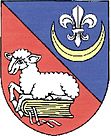
After the abolition of patrimonial Skorotice formed a municipality in the Brno district from 1850 . In 1897 she came to the Tišnov District . In 1900 Skorotice consisted of 26 houses and 169 inhabitants. In 1947 the community was assigned to the Okres Bystřice nad Pernštejnem. In 1961 Chlébské was incorporated and the community came to Okres Žďár nad Sázavou . Since November 13, 2008, the community has had a coat of arms and a banner.
Local division
The municipality Skorotice consists of the districts Chlébské ( Chliwsky ) and Skorotice ( Skorotitz ), which also form cadastral districts. The Louky settlement also belongs to Skorotice.
Attractions
- Chapel of the Virgin Mary, the clapboard-roofed building has existed since the 14th century and is protected as a cultural monument
- former school, built in 1895
- Chapel of John the Baptist in Chlébské, built in 1872
- former mill in Chlébské
- two wooden chalets in Chlébské

