Nyklovice
| Nyklovice | ||||
|---|---|---|---|---|
|
||||
| Basic data | ||||
| State : |
|
|||
| Region : | Kraj Vysočina | |||
| District : | Žďár nad Sázavou | |||
| Area : | 332 ha | |||
| Geographic location : | 49 ° 36 ′ N , 16 ° 20 ′ E | |||
| Height: | 672 m nm | |||
| Residents : | 165 (Jan. 1, 2019) | |||
| Postal code : | 592 65 | |||
| License plate : | J | |||
| traffic | ||||
| Street: | Bystré - Olešnice | |||
| structure | ||||
| Status: | local community | |||
| Districts: | 1 | |||
| administration | ||||
| Mayor : | František Burša (as of 2018) | |||
| Address: | Nyklovice 42 592 65 Rovečné |
|||
| Municipality number: | 596272 | |||
| Website : | www.obecnyklovice.cz | |||
Nyklovice (German Niklowitz ) is a municipality in the Czech Republic . It is located three kilometers south of Bystré and belongs to the Okres Žďár nad Sázavou .
geography
Nyklovice is located in the Bohemian-Moravian Highlands in the headwaters of the Nyklovický potok . The Moravian village is located south of the historical border between Moravia and Bohemia . To the southeast rises the Kamenec (698 m), in the south the Horní les ( Oberwald , 774 m), west the Uherkova skalka (729) and in the northwest the Bořina (740 m).
Neighboring towns are Bystré in the north, Hartmanice , Babky and Svojanov in the north-east, Hlásnice in the east, Trpín in the south-east, Rovečné and Dudkovice in the south, Chlum , Korouhvice and Polom in the south-west, Sulkovec in the west and Nedvězíčko and Nedvězí in the north-west.
To the east of Nyklovice lies the Kamenec desert. The settlement was burned down by the Swedes during the Thirty Years War and was never rebuilt.
history
Mykulaschowicze was first mentioned in writing in 1335, when Jimram von Ausperg's daughter Jeruše gave the village to the Doubravník Augustinian monastery. In 1290 the village is mentioned as Niklowitz . The place name is derived from the German name Nikl (short form of Nikolaus ), in the sense of Dorf des Nikl (Niklsdorf). After the destruction of the monastery by the Hussites , Mikulášovice fell back to the Lords of Pernstein. In 1590 they sold the village and it became part of the Kunstadt rule . In the Josephine cadastre of 1789 the place was called Niklowitz.
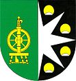
After the abolition of patrimonial Mikulovice / Niklowitz formed a municipality in the Boskovice district . In the following the village was also called Niklovice and since the beginning of the 20th century as Nyklovice. In 1949 the community came to Okres Bystřice nad Pernštejnem and from 1961 to Okres Žďár nad Sázavou . Between 1976 and 1990 Nyklovice was incorporated into Rovečné . Nyklovice has had a coat of arms and a banner since 1997. There is an outdoor swimming pool in the village.
Local division
No districts are shown for the municipality of Nyklovice.
Attractions
- Chapel of St. John of Nepomuk, on the village square, built in 1864
- Chapel of the Exaltation of St. Cross, built in 1934 in the functionalist style, Prof. Josef Heger contributed to the cost of the construction
- Lookout tower on the Horní les
- The meander of the Nyklovický potok, one kilometer southwest of the village, has been protected as a natural monument on an area of 11.7 hectares since 1990.
Sons and daughters of the church
- Josef Heger (1885–1952), professor of biblical science and oriental languages at Charles University in Prague and dean of the theological faculty
- Ladislav Heger (1902–1975), publicist and translator
Web links
Individual evidence
- ↑ http://www.uir.cz/obec/596272/Nyklovice
- ↑ Český statistický úřad - The population of the Czech municipalities as of January 1, 2019 (PDF; 7.4 MiB)
- ↑ L. Hošák, R. Šrámek, Místní jména na Moravě a ve Slezsku I, Academia, Praha 1970, II, Academia, Praha 1980th

