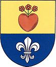
Petráveč
| Petráveč | ||||
|---|---|---|---|---|
|
||||
| Basic data | ||||
| State : |
|
|||
| Region : | Kraj Vysočina | |||
| District : | Žďár nad Sázavou | |||
| Area : | 368 ha | |||
| Geographic location : | 49 ° 20 ' N , 16 ° 3' E | |||
| Height: | 485 m nm | |||
| Residents : | 259 (Jan. 1, 2019) | |||
| Postal code : | 594 01 | |||
| License plate : | J | |||
| traffic | ||||
| Street: | Velké Meziříčí - Tasov | |||
| structure | ||||
| Status: | local community | |||
| Districts: | 1 | |||
| administration | ||||
| Mayor : | Miloš Kratochvíl (as of 2018) | |||
| Address: | Petráveč 40 594 01 Velké Meziříčí |
|||
| Municipality number: | 596418 | |||
| Website : | www.petravec.cz | |||
Petráveč (German Petrowitz , also Petrawetz , Petersdorf ) is a municipality in the Czech Republic . It is located three kilometers southeast of Velké Meziříčí and belongs to the Okres Žďár nad Sázavou .
geography
Petráveč is located in the Krischanauer Uplands ( Křižanovská vrchovina ) in the south of the Bohemian-Moravian Highlands . The village lies on the left side above the Nesměřské údolí valley of the Oslava on the hill Čihadlo (507 m). To the east is the Obora forest area ( Petrowitzer Gehege ). In the west rises the Nesměř (493 m). The D 1 motorway passes to the northeast .
Neighboring towns are Děkanův Dvůr, Domky and Dolní Radslavice in the north, Březejc in the north-east, Jabloňov in the east, Dolní Heřmanice , Eliášova Myslivna and Studnice in the south, Nesměř and Rohy in the south-west, Osové in the west and Oslavice and Velké Meziří in the north.
history
The first written mention of the desert village Malá Lhota took place in 1456 in the course of a dispute between the Meziříč pastor Beneš and the Meziříčí rule. In the corridors of Malá Lhota a village emerged again in the 17th century, which was subordinate to the Dubov dean's court and which has been evidenced by the new name Petrova Ves ( Petersdorf ) since 1641 . It was later referred to as Petrovice and Petraves. Between 1657 and 1678 Petrovice was part of the Velké Meziříčí rule, after which it returned to the property of the Velké Meziříčí dean's court. Iron ore mining began on the Kaliště hill in the 18th century . To the east of the village was the enclosure of the Velké Meziříčí castle. A celebration in the Petrovice enclosure is depicted on a mural in the Velké Meziříčí castle.
After the abolition of patrimonial Petrovice formed from 1850 a district of the municipality Dolní Heřmanice in the district administration Velké Meziříčí. In 1882 the Petrovice commune was established. The place has been called Petráveč since 1920. At the beginning of 1961 the community was assigned to the Okres Žďár nad Sázavou . Petráveč was incorporated into Velké Meziříčí in 1980. The community has existed again since 1992.
Community structure
No districts are shown for the municipality of Petráveč. Petráveč includes the Domky settlement and the one-layer Děkanův Dvůr ( deanery ). Basic settlement units are Domky and Petráveč.
Attractions
- Loupežnický most , also Vysoký most , the stone bridge over the Vodra brook on the old imperial road from Prague to Vienna was built in 1593 by Antonín Vlach
- Nesměřské údolí valley of the Oslava
- Chapel of St. Jungfrau, built in 1914 in place of a bell tower
- stone cross from 1904, above the chapel
- Stone cross, erected in 1899, on the wayside cross in front of the enclosure
- Atonement stone on the road to Velké Meziříčí
- Remains of the castle Templštejn ( temple stone ), south of the village on the mouth of a creek in the Oslava in Eliášova Myslivna ( Forsthaus Elias ).
Web links
Individual evidence
- ↑ http://www.uir.cz/obec/596418/Petravec
- ↑ Český statistický úřad - The population of the Czech municipalities as of January 1, 2019 (PDF; 7.4 MiB)
- ↑ L. Hošák, R. Šrámek, Místní jména na Moravě a ve Slezsku I, Academia, Praha 1970, II, Academia, Praha 1980th
- ↑ http://www.uir.cz/zsj-obec/596418/Obec-Petravec

