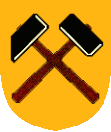
Hamry nad Sázavou
| Hamry nad Sázavou | ||||
|---|---|---|---|---|
|
||||
| Basic data | ||||
| State : |
|
|||
| Region : | Kraj Vysočina | |||
| District : | Žďár nad Sázavou | |||
| Area : | 712 ha | |||
| Geographic location : | 49 ° 34 ' N , 15 ° 54' E | |||
| Height: | 554 m nm | |||
| Residents : | 1,582 (Jan 1, 2019) | |||
| Postal code : | 591 01 | |||
| License plate : | J | |||
| traffic | ||||
| Street: | Přibyslav - Žďár nad Sázavou | |||
| Railway connection: | Brno-Havlíčkův Brod | |||
| structure | ||||
| Status: | local community | |||
| Districts: | 3 | |||
| administration | ||||
| Mayor : | Hubert Křesťan (as of 2018) | |||
| Address: | Hamry nad Sázavou 322 591 01 Hamry nad Sázavou |
|||
| Municipality number: | 595586 | |||
| Website : | www.hamryns.cz | |||
Hamry nad Sázavou (German Figlhammer , also wing hammer ) is a municipality in the Czech Republic . It is located three kilometers west of Žďár nad Sázavou on the Sázava and belongs to the Okres Žďár nad Sázavou .
geography
Hamry nad Sázavou is located on the upper reaches of the Sázava in the Saar mountains . The 674 m high Preperek rises to the northeast. State road 19 between Přibyslav and Žďár nad Sázavou runs through the village on both sides of the river .
Neighboring towns are Žďár nad Sázavou in the east, Radonín in the southeast, Česká Mez in the south, Sázava in the east, and Samotín and Velká Losenice in the northeast.
history
Silver mining took place on Preperek Mountain as early as the Middle Ages, and iron ore mining began around 1300 when the deposit was exhausted. When a large deposit was opened up in the 14th century, the Wenceslas hammer was the first iron hammer and around it the settlement of Najdek, which belonged to the property of the Žďár monastery . In 1407 the Nikolaushammer, which later became the Figlhammer, and the Heršovský hammer, from which the Frendelhammer emerged, were in operation. The hammer was founded in 1453 by hammer master Hans.
At the transition from the 17th to the 18th century, iron ore mining declined and after the opening of a quarry, the ironworks were shut down.
In 1897 the construction of the railway from Německý Brod to Žďár nad Sázavou began and on December 21, 1898 the first train left. In October 1930 there was a large snow and wind break in the forests of the Žárské vrchy , for the removal of which a forest railway was built, which led to the Velké Dářko .
The double-track expansion of the line between Deutschbrod and Brno began in 1939 and was completed on December 20, 1953. 1954 Najdek including the district Šlakhamry was incorporated. Horní Hamry has always been part of Dolní Hamry.
In 1970 a culture house was inaugurated after six years of construction. In April 1975 it was incorporated into Žďár nad Sázavou and since July 1, 1990 Hamry nad Sázavou has been an independent municipality again.
Local division
The municipality Hamry nad Sázavou consists of the districts Najdek ( Neudek in Moravia ), Šlakhamry ( hammer ) and Hamry nad Sázavou. The latter is made up of the localities Dolní Hamry ( Figlhammer ) and Horní Hamry ( Frendel ). Dolní Hamry is on the left bank of the river, while all other districts are on the right.
The municipality is divided into the cadastral districts of Hamry nad Sázavou and Najdek na Moravě.
Attractions
- Stone bridge over the Sázava, built around 1800
- Brdíčkův mlýn watermill in Šlakhamry, originally an iron hammer, branch of the Technical Museum in Brno
Individual evidence
- ↑ http://www.uir.cz/obec/595586/Hamry-nad-Sazavou
- ↑ Český statistický úřad - The population of the Czech municipalities as of January 1, 2019 (PDF; 7.4 MiB)
- ↑ L. Hošák, R. Šrámek, Místní jména na Moravě a ve Slezsku I, Academia, Praha 1970, II, Academia, Praha 1980th
- ↑ http://www.uir.cz/casti-obce-obec/595586/Obec-Hamry-nad-Sazavou
- ↑ http://www.uir.cz/katastralni-uzemi-obec/595586/Obec-Hamry-nad-Sazavou

