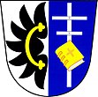
Pavlov u Velkého Meziříčí
| Pavlov | ||||
|---|---|---|---|---|
|
||||
| Basic data | ||||
| State : |
|
|||
| Region : | Kraj Vysočina | |||
| District : | Žďár nad Sázavou | |||
| Area : | 1163 ha | |||
| Geographic location : | 49 ° 27 ' N , 15 ° 55' E | |||
| Height: | 574 m nm | |||
| Residents : | 342 (Jan. 1, 2019) | |||
| Postal code : | 594 44 | |||
| License plate : | J | |||
| traffic | ||||
| Street: | Černá - Radostín nad Oslavou | |||
| structure | ||||
| Status: | local community | |||
| Districts: | 2 | |||
| administration | ||||
| Mayor : | Antonín Havlíček (as of 2018) | |||
| Address: | Pavlov 100 594 44 Radostín nad Oslavou |
|||
| Municipality number: | 596396 | |||
| Website : | www.pavlovzr.cz | |||
Pavlov (German Pawlow ) is a municipality in the Czech Republic . It is located 13 kilometers northwest of Velké Meziříčí and belongs to the Okres Žďár nad Sázavou .
geography
Pavlov is located on the edge of the Arnolecké hory , a part of the Bohemian-Moravian Highlands , by the Pavlovský creek. To the east is the Podvesník pond and to the north the Staropavlovský rybník and Znětíněcký rybník. In the south rise the Kříb (667 m) and Dědkovská hora (694 m), southwest of the Kyjov (702 m) and in the northwest the Hudcova skála (663 m) and V Kopečku (663 m).
Neighboring towns are Pokojov and Znětínek in the north, Radostín nad Oslavou in the Northeast, Kněževes , Vrbův Mlyn and Krásněves the east, Záhradište and Zadní Zhořec the southeast, Dedkov in the south, Milíkov and Kyjov in the southwest, Chroustov the west and Stary Telečkov in the northwest.
history
The first written mention of the village belonging to the Mostiště dominion took place in 1370, when Bohuň von Mostiště left the place to the Margrave Johann Heinrich . According to ancient traditions, the village and a castle originally stood north on the Starý Pavlov corridor and were much larger. At the end of the 14th century Pavlov was added to the Meziříčí rule . During the division of power in 1515, Vladislav Meziříčský received the village from Lomnice. Pavlov became part of the Ostrov nad Oslavou manor .
After the replacement of patrimonial Pavlov formed from 1850 with the district Starý Telečkov a municipality in the district administration Velké Meziříčí . At the beginning of 1961 the Okres Velké Meziříčí was dissolved and the municipality was assigned to the Okres Žďár nad Sázavou . In 1980 it was incorporated into Radostín nad Oslavou . The Pavlov municipality has existed again since 1991.
Community structure
The municipality Pavlov consists of the districts Pavlov ( Pawlow ) and Starý Telečkov ( Old Teletschkau ), which also form cadastral districts.
Attractions
- Church of St. James and Philip, the originally Gothic building from the 13th century was provided with fortification walls in the 15th century. In 1792 there was a baroque reconstruction and the addition of the tower
- Rectory, built at the end of the 18th century
- Stone cross on the church, erected in 1810
- former blacksmith shop on the village square
- Chapel in Starý Telečkov
Personalities
- Antonín Hugo Bradáč (1911–1974), the poet and narrator, worked as a pastor in Pavlov. His grave is in the local cemetery.
Individual evidence
- ↑ http://www.uir.cz/obec/596396/Pavlov
- ↑ Český statistický úřad - The population of the Czech municipalities as of January 1, 2019 (PDF; 7.4 MiB)
- ↑ http://www.uir.cz/casti-obce-obec/596396/Obec-Pavlov
- ↑ http://www.uir.cz/katastralni-uzemi-obec/596396/Obec-Pavlov


