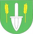
Milešín
| Milešín | ||||
|---|---|---|---|---|
|
||||
| Basic data | ||||
| State : |
|
|||
| Region : | Kraj Vysočina | |||
| District : | Žďár nad Sázavou | |||
| Area : | 292 ha | |||
| Geographic location : | 49 ° 22 ' N , 16 ° 12' E | |||
| Height: | 537 m nm | |||
| Residents : | 81 (Jan. 1, 2019) | |||
| Postal code : | 594 51 | |||
| License plate : | J | |||
| traffic | ||||
| Street: | Vidonín - Březí | |||
| structure | ||||
| Status: | local community | |||
| Districts: | 1 | |||
| administration | ||||
| Mayor : | Milada Strakerlová (as of 2018) | |||
| Address: | Milešín 42 594 51 Křižanov |
|||
| Municipality number: | 587770 | |||
| Website : | www.milesin.cz | |||
Milešín (German Mileschin , also Milleschin ) is a municipality in the Czech Republic . It is located ten kilometers north of Velká Bíteš and belongs to the Okres Žďár nad Sázavou .
geography
Milešín is located in the Křižanovská vrchovina ( Krischanauer Uplands ) belonging to the Bohemian-Moravian Highlands on the left side above the valley of the Halda brook. To the north rises the Strážnice (583 m), in the southwest of the Malý kamenný vrch (592 m), to the west of the Svatá hora (679 m) and in the northwest of the Kříb (620 m).
Neighboring towns are Nová Ves and Radňoves in the north, Vidonín in the northeast, Rojetín in the east, Rozseč in the southeast, Březí and Ondrušky in the south, Skřinářov and Ořechov in the southwest, Rohy and Kadolec in the west and Heřmanov in the northwest.
history
The village belonging to the Meziříčí rule was first mentioned in documents in 1364. In the second half of the 15th century, Milešín was owned by Jiří and Hartlib Vojna from Litava. After their death, Milešín fell to the crown and in 1482 Matthias Corvinus gave the village to Mrakeš von Noskov. From 1498 Milešín belonged to the Lechvický von Zástřizl . From these it was acquired by Johann von Pernstein in 1512 . At the beginning of the 17th century, Milešín came to the rule of Ossowa . In 1617 Dobeš von Meziříčí set Viktorin von Schönwald as the heir of Milešín. It is believed, however, that Milešín has had a hereditary court since 1420 . The place was parish after Hermannschlag .
After the abolition of patrimonial Milešín formed from 1850 a district of the Hermannschlag municipality in the district administration of Groß Meseritsch in the Iglauer Kreis. In 1878 the political municipality of Milešín was established. In 1900 the village consisted of 33 houses and had 245 inhabitants. The Milešín Volunteer Fire Brigade was founded in 1926. From 1949 the municipality belonged to the Okres Velká Bíteš. After a property burned down, a fire extinguishing water pond was created in Oberdorf in 1951. On May 10, 1953, when the trees were in bloom, 20 cm of snow fell and remained there for two days. At the beginning of 1961 the incorporation to Heřmanov took place, at the same time the village was assigned to the Okres Žďár nad Sázavou . Between 1968 and 1969 the road to Heřmanov was built, after its completion on November 25, 1969 the bus service to Milešín was started. Road construction to Vidonín began in the same year and was completed in 1978. 1992 Milešín became independent again.
Local division
No districts are shown for the municipality of Milešín. The Musilov holiday complex belongs to Milešín.
Attractions
- Bell tower and wooden cross on the village square
- Heřmanov nature reserve , west of the village on the road between Heřmanov and Skřinářov. The 1.89 hectare protected area, which has existed since October 19, 1979, is an important mineral discovery site. The Heřmanovské koule ( Hermannschlager spheres ) are a conglomerate of anthophyllite with inclusions of phlogopite .


