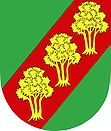
Brumov
| Brumov | ||||
|---|---|---|---|---|
|
||||
| Basic data | ||||
| State : |
|
|||
| Region : | Jihomoravský kraj | |||
| District : | Brno-venkov | |||
| Area : | 284 ha | |||
| Geographic location : | 49 ° 28 ' N , 16 ° 26' E | |||
| Height: | 542 m nm | |||
| Residents : | 245 (Jan. 1, 2019) | |||
| Postal code : | 679 23 | |||
| License plate : | B. | |||
| traffic | ||||
| Street: | Černovice - Lomnice | |||
| structure | ||||
| Status: | local community | |||
| Districts: | 1 | |||
| administration | ||||
| Mayor : | Josef Kubíček (as of 2009) | |||
| Address: | Brumov 98 679 23 Lomnice u Tišnova |
|||
| Municipality number: | 581402 | |||
Brumov ( German Brumow ) is a municipality in the Czech Republic . It is located 13 kilometers north of Tišnov and belongs to the Okres Brno-venkov .
geography
Brumov is located in the Sýkořská pahorkatina, a subunit of the Nedvědická vrchovina in the Bohemian-Moravian Highlands . The village is located on the upper reaches of the Besének stream in the eastern part of the Svratecká hornatina nature park. To the east rises the Láze (642 m), in the southwest of the Sýkoř (702 m), west of the Bukový vrch (699 m) and in the northwest of the Hrádky (627 m).
Neighboring towns are Černovice in the north, Hluboké u Kunštátu , Touboř and Kunice in the north-east, Lhota u Lysic and Bedřichov in the east, Kunčina Ves and Kozárov in the south-east, Žleby and Osiky in the south, Křeptov, Křížovice and Louky in the south-west, Skorotice and Chlébéice in the west and Horní Čepí in the northwest.
history
The first written mention of the place took place in 1390 as part of the Lomnice manor .
After the abolition of patrimonial Brumov formed from 1850 a municipality in the Brno district and judicial district of Tischnowitz . Since 1896 the community belonged to the newly formed district of Tischnowitz. After the dissolution of Okres Tišnov, Brumov came to Okres Blansko at the beginning of 1961 . Since the beginning of 2007 the municipality belongs to the Okres Brno-venkov .
Community structure
No districts are shown for the municipality of Brumov.
Attractions
- Chapel of the Assumption of Mary, built in 1923. Before that, a chapel had existed since 1912, which was demolished due to road construction.
- several marble crosses
- Vršky u Brumova , the 5.64 hectare karst area is characterized by a variety of heat-loving plants on a karstified phyllite layer .

