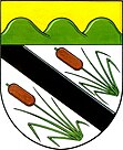
Popůvky
| Popůvky | ||||
|---|---|---|---|---|
|
||||
| Basic data | ||||
| State : |
|
|||
| Region : | Jihomoravský kraj | |||
| District : | Brno-venkov | |||
| Area : | 745 ha | |||
| Geographic location : | 49 ° 11 ′ N , 16 ° 29 ′ E | |||
| Height: | 288 m nm | |||
| Residents : | 1,608 (Jan 1, 2019) | |||
| Postal code : | 664 41 | |||
| License plate : | B. | |||
| traffic | ||||
| Street: | Brno - Rosice | |||
| structure | ||||
| Status: | local community | |||
| Districts: | 1 | |||
| administration | ||||
| Mayor : | Jitka Polášková (as of 2009) | |||
| Address: | Náves 25, Popůvky 664 41 Troubsko |
|||
| Municipality number: | 583669 | |||
| Website : | www.popuvky.cz | |||
Popůvky (German Popuwek ) is a municipality in the Czech Republic . It is located nine kilometers west of the city center of Brno on the outskirts and belongs to the Okres Brno-venkov .
geography
Popůvky is located in the northern foothills of the Thaya-Schwarza valley basin at the transition to Bobravská vrchovina . The village is traversed by Troubský potok ( Mühlbach ), the northern parts of the municipality by Augšperský potok. The Mladý vrch (379 m) and the Kohoutovická Baba (415 m) rise to the northeast, the Šibeník (428 m) to the southwest, the Kukanec (436 m) and the Hvízdalka (442 m) to the northwest and the Baba (424 m) to the northwest. .
The D1 / E 55 / E 65 motorway runs through Popůvky , the next exit 182 Kývalka is three kilometers northwest of the village. To the north-west lies the Brno Automotodrom .
Neighboring towns are Žebětín in the north, Bystrc, Komín, Jundrov and Kohoutovice in the northeast, Veselka and Bosonohy in the east, Troubsko in the southeast, Střelice in the south, Omice in the southwest, Tetčice and Rosice in the west and Kývalka and Ostrovačice in the northwest.
history
The first written mention of the village took place in 1349. The place was at that time the seat of Vladikengeschlechts of Popůvky. Later the goods were attached to the Rossitz rule . Before the abolition of the manors, Popůvky was subject to the independent Strutz estate, which had a manorial court in Popůvky.
After the abolition of patrimonial Popůvky / Popuwek formed a district of Troubsko in the Brno district from 1850 . In 1880 the place became independent. In 1921 Popůvky came to the Okres Brno-venkov. Between 1930 and 1937 the race track of the 29.1 km long Brno Ring, later named Masaryk Ring in honor of President Tomáš Garrigue Masaryk , ran through Popůvky. The start and finish was at Bosonohy. In 1948 the municipality was assigned to the Okres Brno-okolí. After its cancellation, Popůvky came back to Okres Brno-venkov in 1961. The motorway was built between 1969 and 1972 and it cuts through Popůvky immediately north of the village square. In 1984 the construction of the new Automotodrom Brno began in the forest area of Podkomorské lesy . The communist government of Štrougal pushed through the plans against the protests of residents of the surrounding villages and nature conservationists against the large-scale project in the forest. The new track was inaugurated in 1987 with a round of the motorcycle world championship .
Popůvky today consists of 214 houses, plus 410 cottages in the recreation area on Bosonožský hájek. The municipality covers 430 hectares of forest. The motorway that cuts through the town center leads to noise pollution and pollution of the groundwater.
Community structure
No districts are designated for the Popůvky community.
Attractions
- chapel
- Augšperský potok nature reserve, northwest of Popůvky below the racing circuit
- Bosonožský hájek nature reserve, north of the village
- Podkomorské lesy nature park, northwest of Popůvky behind the race track
- Dolní rybník and Horní rybník ponds on Augšperský potok with 14 hectares of water, north of the village
- Masaryk ring
Sons and daughters of the place
- Wilhelm Puttik (1856–1929), forest engineer and speleologist

