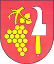
Neslovice
| Neslovice | ||||
|---|---|---|---|---|
|
||||
| Basic data | ||||
| State : |
|
|||
| Region : | Jihomoravský kraj | |||
| District : | Brno-venkov | |||
| Area : | 582 ha | |||
| Geographic location : | 49 ° 9 ' N , 16 ° 23' E | |||
| Height: | 338 m nm | |||
| Residents : | 933 (Jan. 1, 2019) | |||
| Postal code : | 664 16 | |||
| License plate : | B. | |||
| traffic | ||||
| Street: | Ivančice - Rosice | |||
| structure | ||||
| Status: | local community | |||
| Districts: | 1 | |||
| administration | ||||
| Mayor : | Karel Kuča (as of 2010) | |||
| Address: | Hlavní 14 664 91 Neslovice |
|||
| Municipality number: | 583481 | |||
| Website : | www.neslovice.cz | |||
Neslovice (German Neßlowitz , also Nesslowitz ) is a municipality in the Czech Republic . It is located five kilometers north of Ivančice and belongs to the Okres Brno-venkov .
geography
Neslovice is located in the southern part of the Boskowitz furrow . The village extends in the basin of the Neslovický brook. To the east lies the Bobrava Nature Park. To the northeast rose the Bučín (444 m) and Tmavý žlíbek (421 m), to the east the Herzán (452 m) and Teplý Kopec (438 m), southeast the Špidleny (461 m) and the Veselá hora (392 m).
Neighboring towns are Pod Trojicí, Pendrov, Rosice and Tetčice in the north, Omice in the northeast, U Nádraží, Střelice and Radostice in the east, Prštice , Špidleny and Hlína in the southeast, Kopaniny and Ivančice in the south, Oslavany and Padochov in the southwest, Mašinka and Důl Anna in the west and Zbýšov and Kratochvilka in the northwest.
history
Archaeological investigations brought to light an extensive settlement site from the Upper Paleolithic between Neslovice and Hlína .
The village was first mentioned in writing in 1342 as the property of the Rosa Coeli monastery . After the monastery was extinguished in 1528, the Bohemian King and later Emperor Ferdinand I added the extensive monastery property to the crown property. In 1532 he pledged the Dolní Kounice estate to his vice-chancellor Jiří Žabka von Limberg, who was entered in the land register on October 9, 1537 as the hereditary owner . During the Thirty Years' War Neslovice became deserted, in 1656 17 of the 31 properties in the village were in desolation. After the church was built, a locality was set up in Neslovice, and from 1787 Hlína belonged to its district . At the beginning of the 19th century, the coal deposits in the Rossitz-Oslawan Basin began to be extracted. Subsequently, Neslovice grew and next to the farms there were numerous miners who worked in the Zbýšov coal mine . In 1805 a village school was inaugurated in Neslovice. Until the middle of the 19th century, the village always remained submissive to Dolní Kounice.
After the abolition of patrimonial Neslovice formed from 1850 a municipality in the district authority of Brno . In 1921 the municipality was assigned to the Okres Brno-venkov. Until 1927 Kratochvilka was also enrolled in Neslovice. Between 1948 and 1960 Neslovice belonged to the Okres Rosice. After its abolition, the parish came back to Okres Brno-venkov. In 1980 Hlína and Kratochvilka were incorporated; both villages broke up in 1990.
Community structure
No districts are shown for the municipality of Neslovice.
Attractions
- Maria Wiegenfest church at the northern end of the village, late baroque building from the years 1782–1784
- Classicist Chapel of St. Gotthard and Florian, built in the 19th century on an elevated square in the center of the village
- Memorial to the victims of the First World War, next to the chapel
- Patočkova hora nature reserve on a hilltop northeast of the village
- Rybičková skála nature reserve in the Neslovický potok valley, west of the village
Sons and daughters of the church
- Antonín H. Sokol (1847-1889), journalist and writer, also known as AH Neslovský known

