Bílovice nad Svitavou
| Bílovice nad Svitavou | ||||
|---|---|---|---|---|
|
||||
| Basic data | ||||
| State : |
|
|||
| Region : | Jihomoravský kraj | |||
| District : | Brno-venkov | |||
| Area : | 1470 ha | |||
| Geographic location : | 49 ° 15 ′ N , 16 ° 40 ′ E | |||
| Height: | 236 m nm | |||
| Residents : | 3,723 (Jan 1, 2019) | |||
| Postal code : | 664 01 | |||
| License plate : | B. | |||
| traffic | ||||
| Street: | Brno - Adamov | |||
| Railway connection: | Brno – Česká Třebová | |||
| structure | ||||
| Status: | local community | |||
| Districts: | 1 | |||
| administration | ||||
| Mayor : | Pavel Doležal (as of 2010) | |||
| Address: | Komenského 446 664 01 Bílovice nad Svitavou |
|||
| Municipality number: | 582824 | |||
| Website : | www.bilovice-nad-svitavou.cz | |||
Bílovice nad Svitavou (German Bilowitz , formerly Billowitz ) is a municipality in the Czech Republic . It is located eight kilometers northeast of the city center of Brno on the city limits and belongs to the Okres Brno-venkov .
geography
Bílovice nad Svitavou is located in the southwest of the Drahan Mountains in the Svitava Valley . The village, surrounded by wooded hills, is located south of the Moravian Karst in a basin at the mouth of the Praskavice, Časnýř, Kuní potok and Melatín streams. The Hády (424 m) rises to the south and the Ostrá horka ( Stromberg , 404 m) to the west .
Neighboring towns are Adamov , Ptačinek and Babice nad Svitavou in the north, Řícmanice in the north-east, Obce , Ochoz u Brna and Horní Mlýn in the east, Mokrá-Horákov in the south-east, Líšeň and Maloměřice in the south, Obřany and Brno-sever in the south-west, Sadšová and Soběšová in the west and Ořešín and Útěchov in the northwest.
history
Bílovice was founded on the basis of archaeological finds in the 11th century. The first written mention of the place took place in 1498 as the property of Jan Bílovský of Vrbětín. In the years 1843 to 1848 the railway line Česká Třebová – Brno was built .
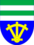
After the abolition of patrimonial Bilovice / Billowitz formed from 1850 a political municipality in the district administration Brno . The place name Bílovice has been used since the end of the 19th century . In 1921 Bílovice was assigned to the Okres Brno-venkov and since 1925 the municipality has had the official suffix nad Svitavou . Between 1948 and 1960 Bílovice nad Svitavou was part of the Okres Brno-okolí and since 1961 the village has belonged again to the Brno-venkov. The community has had a coat of arms and a banner since 1998.
Community structure
No districts have been identified for the municipality of Bílovice nad Svitavou. The single-layer Resselová hájovna belongs to Bílovice nad Svitavou .
Attractions
- Church of St. Kyrill und Method, built between 1908 and 1913
- chapel
- Zadní Hády nature reserve, east of the village by the Hegerhaus Resselová hájovna
- Kněžnice nature reserve, north of the village
- Remains of Obřany Castle , above the Těsnohlídkovo údolí valley south of the village
- Leoš Janáček spring, at Kuní potok
- Monument to Josef Konšel
- Arboretum, in a clearing north of the village
- Havelka-Ziegler memorial, in the forest northwest of Bílovice
- Resselden monument , southeast of the Resselová hájovna Hegerhaus
- Memorial plaque for Rudolf Těsnohlídek, in the valley Těsnohlídkovo údolí south of the village


