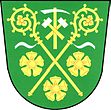
Rudka (Czech Republic)
| Rudka | ||||
|---|---|---|---|---|
|
||||
| Basic data | ||||
| State : |
|
|||
| Region : | Jihomoravský kraj | |||
| District : | Brno-venkov | |||
| Area : | 414 ha | |||
| Geographic location : | 49 ° 15 ' N , 16 ° 20' E | |||
| Height: | 445 m nm | |||
| Residents : | 396 (Jan. 1, 2019) | |||
| Postal code : | 664 83 | |||
| License plate : | B. | |||
| traffic | ||||
| Street: | Domašov - Rosice | |||
| structure | ||||
| Status: | local community | |||
| Districts: | 1 | |||
| administration | ||||
| Mayor : | Věra Kožnarová (status: 2009) | |||
| Address: | Rudka 66 664 83 Domašov u Brna |
|||
| Municipality number: | 583804 | |||
| Website : | www.obecrudka.cz | |||
Rudka (German Rutkau ) is a municipality in the Czech Republic . It is located 21 kilometers west of the city center of Brno and belongs to the Okres Brno-venkov .
geography
Rudka is located in the Bobravská vrchovina on the upper reaches of the Bobrava, which rises in the forest northwest of the village. The Prachová (530 m) rises to the north. The D1 / E 55 / E 65 motorway passes in the north, the next exit 168 Devět křížů is at Lesní Hluboké . To the southeast, in the Bobrava valley, is the extinct settlement of Chroustov.
Neighboring towns are Šmelcovna in the northeast, Domašov in the east, Říčky in the southeast, Litostrov in the south, Zbraslav in the southwest, Příčnice and Stanoviště in the west and Zálesná Zhoř , Zhořský Dvůr and Lesní Hluboké in the northwest.
history
Rutka was first mentioned in a document in 1330. The place was one of the villages that the widow Queen Elisabeth Richza gave to the Cistercian convent Aula Sanctae Mariae in Old Brno, which she founded. In German writings the village was initially referred to as Ruden . The place name is derived from an ore deposit. At the end of the 15th century a Freihof was established in Rudka as a monastic fief. In 1497, Vladike Jaroš von Rudka was named as the owner of the Rudka farm and fortress . The fortress probably went out during the Thirty Years War . Mining was done on iron ore near Rudka and several hammer mills worked in the village. After the abolition of the Cistercian convent Old Brno, Rudka became part of the religious fund in 1783. In 1840 the former monastery property was sold to Franz Ritter von Heintl. Heinrich Eduard Fürst Schönburg-Hartenstein bought it three years later .
After the abolition of patrimonial Rudka formed a parish in the Brno district from 1850. In the same year a fire destroyed seven farms. In 1852, eleven houses again burned down. As a result, a 58 ares large extinguishing water pond was created on the Bobrava. In 1890 the district road from Domašov to Rudka was laid out, and in the following year it was extended to Litostrov . In 1902 there were 482 people in the village. The community forest was divided up in 1912 and sold to the local farmers. In 1921 the community came to Okres Brno-venkov and in 1948 it was assigned to Okres Rosice. After the Okres Rosice was abolished, Rudka returned to Okres Brno-venkov in 1961. In 1977 Rudka was connected to Domašov along with Litostrov, Říčky and Javůrek . In the same year the house where Josef Juran was born was declared a cultural monument. In 1990 the Rudka community came into being again. In 2002, shooting for the series Černí baroni by Juraj Herz was carried out in the tavern . Rudka has had a coat of arms and a banner since 2005 .
Community structure
No districts are shown for the municipality of Rudka.
Attractions
- Bell tower
- Prayer pillar
- Chroustovské údolí valley of the Bobrava, south of the village
- Remains of the Rudka fortress on Hrádek hill
Sons and daughters of the church
- Josef Juran (1885–1963), KSČ party functionary

