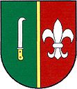
Kobylnice u Brna
| Kobylnice | ||||
|---|---|---|---|---|
|
||||
| Basic data | ||||
| State : |
|
|||
| Region : | Jihomoravský kraj | |||
| District : | Brno-venkov | |||
| Area : | 509 ha | |||
| Geographic location : | 49 ° 8 ' N , 16 ° 44' E | |||
| Height: | 214 m nm | |||
| Residents : | 1,134 (Jan 1, 2019) | |||
| Postal code : | 664 51 | |||
| License plate : | B. | |||
| traffic | ||||
| Street: | Brno - Slavkov u Brna | |||
| Railway connection: | Brno - Blažovice | |||
| Next international airport : | Brno-Tuřany | |||
| structure | ||||
| Status: | local community | |||
| Districts: | 1 | |||
| administration | ||||
| Mayor : | Dana Šmídová (as of 2010) | |||
| Address: | Na Budínku 240 664 51 Kobylnice |
|||
| Municipality number: | 583219 | |||
| Website : | www.kobylnice.cz | |||
Kobylnice , until 1939 Kobelnice , (German Kobelnitz ) is a municipality in the Czech Republic . It is located eleven kilometers southeast of the city center of Brno and belongs to the Okres Brno-venkov .
geography
Kobylnice is located at the foot of the foothills of the Steinitz Forest in the Thaya-Schwarza valley basin . The village extends on the left bank of the Říčka ( Goldbach ). To the east rises the Štosy (232 m), in the southeast of the Pracký Kopec (324 m) and the Stará hora (307 m). Brno-Tuřany Airport is to the northwest . The railway line from Brno to Blažovice passes in the north. The Sokolnice substation is located to the south-west .
Neighboring towns are Šlapanice and Ponětovice in the north, Blažovice in the north-east, Prace in the east, Hostěrádky-Rešov and Újezd u Brna in the south-east, Sokolnice in the south, Vladimírov and Rebešovice in the south-west, Chrlice and Dvorska in the west, and Slatinka and Slatina in the north-west.
history
The village was first mentioned in writing in 1306 in a document from Bishop John VI. Waldstein in which he the Olomouc Schola star the Šlapanicer parish goods and the tithe of belonging to the parish villages Šlapanice, Slatina, Jiříkovice , Kobylnice and Ponětovice left. In the 15th century a festival was established on an island in the Goldbach. At that time Kobylnice had a manorial farm with a brewery and tavern as well as a mill and two ponds. In 1533, the owner of Kobylnice was Jan Kyjovský of Kyjovice, at that time he added the village of Horákov to his estate . In 1563 the fortress was rebuilt under Jan Gbelský von Gbelsko. A commemorative stone with an inscription was found during field work in 1875. In the course of its history the place was called Kobylníky , Kobelnice and Kobelnitz . Later Kobelnice became subordinate to Sokolnice . The last landlords were Count Mitrovský. On December 2, 1805, the village was on the western edge of the battlefield of the Three Emperor Battle .
After the abolition of patrimonial Kobelnice formed from 1850 a district of the municipality Sokolnice in the district administration Brno. The construction of a village school began in 1854, and lessons began two years later. In 1867 Kobelnice broke away from Sokolnice and formed its own municipality. In 1891 a new school building for a two-class operation was inaugurated. The volunteer fire brigade was founded in 1898. In 1932 a syringe house was built on the site of the former fortress. The inscription stone from 1563 was also walled in. Since March 16, 1939 the village has been called Kobylnice . In 1949 a cemetery was established in Kobylnice. Between 1986 and 1990 Kobylnice was incorporated into Šlapanice. The parish is Šlapanice.
Community structure
No districts are shown for the municipality of Kobylnice.
Attractions
- three-sided prayer column, erected in 1908 in place of a Marterl erected in 1769
- Maria Schnee bell tower, built in 1824
- Natural monument Žabárník with the Balaton irrigation reservoir on the Dunávka brook, southwest of the village
- Pracký Kopec with the monument grave mound of peace commemorating the Battle of the Three Emperors

