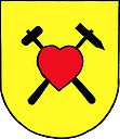
Hostěnice
| Hostěnice | ||||
|---|---|---|---|---|
|
||||
| Basic data | ||||
| State : |
|
|||
| Region : | Jihomoravský kraj | |||
| District : | Brno-venkov | |||
| Area : | 2000 ha | |||
| Geographic location : | 49 ° 14 ' N , 16 ° 47' E | |||
| Height: | 295 m nm | |||
| Residents : | 791 (Jan. 1, 2019) | |||
| Postal code : | 664 04 | |||
| License plate : | B. | |||
| traffic | ||||
| Street: | Ochoz u Brna - Pozořice | |||
| structure | ||||
| Status: | local community | |||
| Districts: | 2 | |||
| administration | ||||
| Mayor : | Václav Čapka (as of 2010) | |||
| Address: | Hostěnice 57 664 04 Mokrá 1 |
|||
| Municipality number: | 583057 | |||
| Website : | obechostenice.cz | |||
Hostěnice (German Hostienitz ) is a municipality in the Czech Republic . It is located 13 kilometers northeast of the city center of Brno and belongs to the Okres Brno-venkov .
geography
Hostěnice is located at the southern foothills of the Drahaner Bergland . The village, surrounded by forests, extends to the right of the Hostěnický stream. To the northwest lies the protected landscape area of Moravský kras , to the north the nature park Říčky. In the southeast rises the Velká Baba (420 m), to the northwest the Lysá hora (428 m). Extensive limestone quarries lie to the south.
Neighboring towns are Hádek, Pod Hádkem and Lhotky in the north, Říčky and Račice in the Northeast, Olšany and Habrovany the east, Vítovice , Viničné Šumice and Pozořice in the southeast, Sivice , Velatice and Mokrá in the south, Horni Mlyn and Prostřední Mlýn in the west and Obce and Ochoz u Brna in the northwest.
history
The first written mention of the village belonging to the Wildenberg rule was made in 1371 when Půta von Wildenberg sold the rule to Margrave Johann Heinrich . Hostěnice, as well as Lhota to the north, belonged to the villages of the dominion that became extinct in the 15th and 16th centuries. While Lhota remained desolate, the Hostěnický potok valley was repopulated in 1580 by a family of ten. In the course of time, forest areas were cleared to gain arable land. Because of the stony soil, agriculture was not very productive, so the residents of Hostěnice earned extra income by making brooms from birch veins. The manufacture of stone ware made of marble and the processing of limestone into quicklime were added later. In 1746, the Pozořice lordship had the Nový Dvůr farm on the Lhota desert. This was later called Lhotky and a hunter's house and a hunter's house were built around the courtyard. In 1842 accommodation for forest workers was added. Lhotky belonged to Březina at that time .
After the abolition of patrimonial Hostěnice formed from 1850 a political municipality in the district administration Wischau . In 1885 Lhotky was reassigned to Hostěnice. In 1898 a school building was built in the community. Between 1950 and 1960 Hostěnice was assigned to the Okres Slavkov and after its abolition the municipality became part of the Okres Brno-venkov . In 1953 the municipal office was built.
Community structure
The Hostěnice municipality consists of the districts Hostěnice ( Hostienitz ) and Lhotky and the holiday settlements Pod Hádkem, Peklo, Pastviska, Říčky and Amstrdam.
Attractions
- Bell tower from 1877
- Forest Chapel of St. Anna, built in 1748
- Hostěnické propadání, Ponor des Hostěnický potok, northwest of the village
- Ponor Estavela, in which the Říčka river disappears and continues underground, northwest of Hostěnice
- Karst cave Pekárna , northwest of Hostěnice at the confluence of the Hostěnický potok in the Říčka
- several karst caves in the Říčka valley, northwest of the village
- Reservoir Pod Hádkem on the Říčka, northwest of the village
- Remains of the Vildenberk castle, in the woods southeast of Hostěnice


