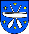
Katov
| Katov | ||
|---|---|---|
| coat of arms | map | |

|
|
|
| Basic data | ||
| State : | Slovakia | |
| Kraj : | Trnavský kraj | |
| Okres : | Skalica | |
| Region : | Záhoria | |
| Area : | 4.274 km² | |
| Residents : | 641 (Dec. 31, 2019) | |
| Population density : | 150 inhabitants per km² | |
| Height : | 164 m nm | |
| Postal code : | 908 49 ( Vrádište Post Office ) | |
| Telephone code : | 0 34 | |
| Geographic location : | 48 ° 50 ' N , 17 ° 10' E | |
| License plate : | SI | |
| Kód obce : | 504432 | |
| structure | ||
| Community type : | local community | |
| Administration (as of November 2018) | ||
| Mayor : | Ivana Chrenková | |
| Address: | Obecný úrad Kátov 41 90849 Kátov |
|
| Website: | www.katov.eu | |
| Statistics information on statistics.sk | ||
Kátov ( German Katow , Hungarian Kátó ) is a municipality in the western Slovakian Kraj Trnava .
It is located in the Záhorie region in the Záhorie lowlands on the Výtržnica brook and the March , opposite the Czech town of Hodonín and between the Slovak towns of Holíč (2 km) and Skalica (5 km).
It was first mentioned in writing in 1392 and belonged to the Holíč estate. The catholic church from 1910, a bell tower and the natural sights Kátovské rameno (Kátov arm) and Kátovské jazero (Kátov lake) are worth seeing .
Web links
Commons : Kátov - collection of pictures, videos and audio files

