Brodské
| Brodské | ||
|---|---|---|
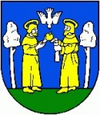
| coat of arms | map | |

|
|
|
| Basic data | ||
| State : | Slovakia | |
| Kraj : | Trnavský kraj | |
| Okres : | Skalica | |
| Region : | Záhoria | |
| Area : | 21.829 km² | |
| Residents : | 2,277 (Dec. 31, 2019) | |
| Population density : | 104 inhabitants per km² | |
| Height : | 160 m nm | |
| Postal code : | 908 85 | |
| Telephone code : | 0 34 | |
| Geographic location : | 48 ° 41 ' N , 17 ° 1' E | |
| License plate : | SI | |
| Kód obce : | 504271 | |
| structure | ||
| Community type : | local community | |
| Administration (as of November 2018) | ||
| Mayor : | Anna Krídlová | |
| Address: | Obecný úrad Brodské Školská 1030 90885 Brodské |
|
| Website: | brodske.sk | |
| Statistics information on statistics.sk | ||
Brodské (until 1927 in Slovak also "Brodsko" or "Brocké"; German Brodsko , older also Pruske , Hungarian Gázlós , until 1907 Brockó ) is a municipality in Kraj Trnava in western Slovakia . It is located in the Záhorie region in the Záhorie lowlands on the March , opposite the Czech municipality of Lanžhot . The neighboring communities are Kúty in the south and the city of Gbely in the east; it is 25 km from Skalica and 67 km from Bratislava .
The first written mention was made in 1163 (establishment of a Catholic parish) or 1273 (under the name Barachka ) and the place belonged to the estate of Holíč , later of Šaštín . There was a ford (slow. Brod ) through the March at the place . The Habaners were settled here in the 16th century, but they no longer existed in the place after 1663.
Today Brodské is an important border crossing to the Czech Republic - a motorway bridge, a road bridge and a railway bridge lead to the Czech communities of Lanžhot and Břeclav . Until June 2007 the cadastral municipality of Štepnice was also part of the municipality.

