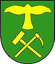
Kanice
| Kanice | ||||
|---|---|---|---|---|
|
||||
| Basic data | ||||
| State : |
|
|||
| Region : | Jihomoravský kraj | |||
| District : | Brno-venkov | |||
| Area : | 823 ha | |||
| Geographic location : | 49 ° 16 ' N , 16 ° 43' E | |||
| Height: | 316 m nm | |||
| Residents : | 1.005 (Jan. 1, 2019) | |||
| Postal code : | 664 01 | |||
| License plate : | B. | |||
| traffic | ||||
| Street: | Bílovice nad Svitavou - Jedovnice | |||
| structure | ||||
| Status: | local community | |||
| Districts: | 1 | |||
| administration | ||||
| Mayor : | Vladimír Kalivoda (Status: 2010) | |||
| Address: | Kanice 76 664 01 Babice nad Svitavou |
|||
| Municipality number: | 583197 | |||
| Website : | www.obeckanice.eud.cz | |||
Kanice (German Kanitz ) is a municipality in the Czech Republic . It is located eleven kilometers northeast of the city center of Brno and belongs to the Okres Brno-venkov .
geography
Kanice is located in the Drahaner Bergland . The village, surrounded by forests, is located on the southern edge of the Moravský kras nature reserve and is traversed by the Hlávečný stream. The Baba (496 m) and Vysoká (492 m) rise to the north and the Skalka (478 m) to the east.
Neighboring towns are Habrůvka and Křtiny in the north, Březina in the northeast, Nový Dvůr, Lhotky and Obce in the east, Ochoz u Brna in the southeast, Řícmanice in the southwest and Ptačinek and Babice nad Svitavou in the northwest.
history
The first written mention of the settlement belonging to the Nový hrad estate was in 1365 as the property of Čeněk Krušina from Lichtenburg . At that time Kanice consisted of a Hegerhaus as well as a few houses in which farmers, charcoal burners and woodcutters lived. There was also a lime distillery. After the destruction of Nový hrad by the Swedes during the Thirty Years' War, Kanice was annexed to the Pozořice dominion . Since the 18th century Kanice belonged to Řícmanice as a cadastral municipality , both villages used a common seal.
After the abolition of patrimonial Kanice formed a district of the municipality Řícmanice in the district administration Brno . In 1867 the village of Kánice was established . At that time 354 people lived in the 50 houses in the village. In 1921 Kanice was assigned to the Okres Brno-venkov . Between 1948 and 1960 the municipality was part of the Okres Brno-okolí. Kanice is now part of the Časnýř microregion.
Part of the security services archive is located in Kanice . Among other things, the documents of the communist secret service Státní bezpečnost are kept here.
Community structure
No districts are shown for the municipality of Kanice.
Partner municipality
- Spillern , Austria, since 2003
Individual evidence
- ↑ Český statistický úřad - The population of the Czech municipalities as of January 1, 2019 (PDF; 7.4 MiB)

