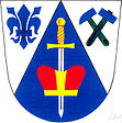
Štěchov
| Štěchov | ||||
|---|---|---|---|---|
|
||||
| Basic data | ||||
| State : |
|
|||
| Region : | Jihomoravský kraj | |||
| District : | Blansko | |||
| Area : | 168 ha | |||
| Geographic location : | 49 ° 27 ' N , 16 ° 30' E | |||
| Height: | 479 m nm | |||
| Residents : | 174 (Jan. 1, 2019) | |||
| Postal code : | 679 71 | |||
| License plate : | B. | |||
| traffic | ||||
| Street: | Lysice - Bedřichov | |||
| structure | ||||
| Status: | local community | |||
| Districts: | 2 | |||
| administration | ||||
| Mayor : | Věra Knotková (as of 2018) | |||
| Address: | Štěchov 29 679 71 Lysice |
|||
| Municipality number: | 582492 | |||
| Website : | www.stechov.cz | |||
Štěchov (German Sczechow , 1939–45: Stiechow ) is a municipality in the Czech Republic . It is located twelve kilometers southwest of Boskovice and belongs to the Okres Blansko .
geography
Štěchov is located on the eastern slope of the Bohemian-Moravian Highlands on a ridge above the valleys of the Lysický and Lhotecký brooks. The village is located in the Lysicko Nature Park. To the northeast are the remains of Rychvald Castle. In the southwest the Babylon rises (656 m).
Neighboring towns are Lhota u Lysic and Záoboří in the north, Drnovice in the northeast, Lysice in the east, Žerůtky and Býkovice in the southeast, Lačnov and Dlouhá Lhota in the south, Kunčina Ves in the west and Bedřichov in the northwest.
history
The existence of Rychvald Castle is documented since 1371 as the seat of Ješek von Kunstadt and Lissitz . The first written mention of the village Sczechow belonging to the foreland of the castle comes from the year 1385. At the beginning of the 15th century the branch of Kunstadt and Lissitz moved its seat to the fortress Lysice . Rychvald Castle was mentioned for the last time in 1437, after which it was considered desolate and was at times a robbery. Ferdinand Leopold Březnický von Náchod sold Sčechov in 1666 to the Drnovice manor . In 1718 Sčechov consisted of eight houses. From 1728 Sčechov was again subject to Lysice. From 1750 there was a manorial farm in Sčechov where sheep was raised. In 1834 the village consisted of 22 houses and had 132 inhabitants.
After the abolition of patrimonial Sčechov formed from 1850 a district of the municipality Lačnov in the district administration Boskovice . In 1854 Sčechov had 150 inhabitants. In 1869 the political municipality Sčechov was established, to which Lačnov belonged as a district. In 1923 the name was changed to Štěchov . After the dissolution of Okres Boskovice, the municipality came to Okres Blansko at the beginning of 1961 . The district of Štěchov had 96 inhabitants in 1991. In March 2001, 36 houses with 104 residents were counted in the Štěchov district.
Community structure
The municipality Štěchov consists of the districts Lačnov ( Lacznow ) and Štěchov ( Sczechow ), which also form cadastral districts.
Attractions
- Remains of the Rychvald Castle, northeast of the village on a spur above the Lysický potok valley
- Chapel of St. John of Nepomuk in Štěchov
- Lady Chapel in Lačnov
- Crossroads in Lačnov

