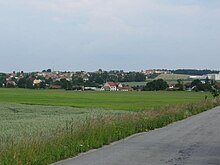
Kotvrdovice
| Kotvrdovice | ||||
|---|---|---|---|---|
|
||||
| Basic data | ||||
| State : |
|
|||
| Region : | Jihomoravský kraj | |||
| District : | Blansko | |||
| Area : | 558 ha | |||
| Geographic location : | 49 ° 21 ' N , 16 ° 47' E | |||
| Height: | 535 m nm | |||
| Residents : | 902 (Jan. 1, 2019) | |||
| Postal code : | 679 07 | |||
| License plate : | B. | |||
| traffic | ||||
| Street: | Jedovnice - Senetářov | |||
| Next international airport : | Brno-Tuřany | |||
| structure | ||||
| Status: | local community | |||
| Districts: | 1 | |||
| administration | ||||
| Mayor : | Alois Kunc (as of 2018) | |||
| Address: | Kotvrdovice 198 679 07 Kotvrdovice |
|||
| Municipality number: | 581763 | |||
| Website : | www.kotvrdovice.cz | |||
Kotvrdovice (German Kordowitz , also Gottfriedschlag ) is a municipality in the Czech Republic . It is ten kilometers east of Blansko and belongs to the Okres Blansko .
geography
Kotvrdovice is located in the basin of the source of the Kotvrdovický creek in the Drahan Mountains . The ChKO Moravský kras protected landscape area extends to the west . In the north rises the Kopáč (560 m), northeast of the Kojál (600 m), in the south of the Lipový Kopec (561 m) and to the west the Strážná (538 m). To the south are the Budkovan and Olšovec ponds. To the southwest is the Dvorce desert.
Neighboring towns are Ostrov u Macochy and Lipovec in the north, Kulířov and Krásensko in the northeast, Senetářov in the east, Ruprechtov in the southeast, Rakovec, Bukovinka and Bukovina in the south, Křtiny , Habrůvka and Jedovnice in the southwest, Lažánky in the west and Vilémovice and Krasová in the north-west.
history
Kotvrdovice was founded in the second half of the 13th century during the colonization of the area by the Lords of Hohlenstein . The first written mention of the village Gottfriedschlag , which belonged to the Jedovnice lordship , took place in 1349. Over time, numerous noble families took turns as owners of the lordship. In 1743 Anton Josef Altgraf von Salm-Reifferscheidt acquired the rule by marriage. After he bought the Raitz estate in 1763 , he joined Jedovnice to Raitz. In 1811 Hugo Franz Altgraf zu Salm-Reifferscheidt took over the management of the family estates.
After the abolition of patrimonial Kotvrdovice / Kordowitz formed from 1850 a municipality in the district authority of Boskowitz . During the German occupation between 1939 and 1945, the community again bore the original name of Gottfriedschlag . In 1948 Kotvrdovice was assigned to the Okres Blansko . There have been contacts with the Bavarian community of Aschheim since 1994 , which were established in a community partnership in 1999. Kotvrdovice has had a coat of arms and a banner since 2004.
To the north of the village is the Kotvrdovice sports airfield (LKKOTV), which is approved for microlight aircraft.
Community structure
No districts are shown for the municipality of Kotvrdovice.
Community partnerships
Attractions
- Chapel of the Sacred Heart of Jesus, built in 1943
- Kojál transmitter with a 339.5 m high transmitter mast on the hill of the same name northeast of the village
- Olšovec and Budkovan ponds at Jedovnický potok . There is a recreation area on the 42 hectare Olšovec.
Sons and daughters of the church
- Zdeněk Zouhar (* 1927), musicologist and composer


