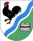
Lubě
| Lubě | ||||
|---|---|---|---|---|
|
||||
| Basic data | ||||
| State : |
|
|||
| Region : | Jihomoravský kraj | |||
| District : | Blansko | |||
| Area : | 353 ha | |||
| Geographic location : | 49 ° 24 ' N , 16 ° 31' E | |||
| Height: | 369 m nm | |||
| Residents : | 94 (Jan. 1, 2019) | |||
| Postal code : | 679 21 | |||
| License plate : | B. | |||
| traffic | ||||
| Street: | Žernovník - Unín | |||
| structure | ||||
| Status: | local community | |||
| Districts: | 1 | |||
| administration | ||||
| Mayor : | Jana Formánková (as of 2018) | |||
| Address: | Lubě 15 679 21 Černá Hora |
|||
| Municipality number: | 581992 | |||
| Website : | lube.webnode.cz | |||
Lubě (German Lubie ) is a municipality in the Czech Republic . It is located nine kilometers northeast of Tišnov and belongs to the Okres Blansko .
geography
Lubě is located in the Boskowitz furrow between the Drahan Uplands and the Bohemian-Moravian Highlands . The village is located at the southern foot of the Jedůvka hill (483 m) in the valley of the Lubě river at the confluence of the Záhořský potok and Johanka brooks. To the northeast rises the Skalky (452 m) and in the southwest the Střela (490 m).
Neighboring towns are Brťov-Jeneč and Býkovice in the north, Žernovník in the northeast, Malá Lhota in the east, Závist and Milonice in the southeast, Újezd u Černé Hory in the south, Hluboké Dvory and Unín in the southwest, Rohozec in the west and Bukovice in the northwest.
history
The first written mention of the village was made in 1360 as part of the Bukovice reign . In 1385 Pešek von Bukovice sold the place to Ježek von Křížánek. This sold the property three years later to Jan von Braslavec. At the beginning of the 15th century, Blažej von Domabořice owned part of the village, and in 1415 he sold it to Jan Kašpar von Bukovice. At the end of the 15th century, the village belonged to the Vladiken von Šerkovice, who were related to the lords of Bukovice . After a division of the village at the beginning of the 16th century, Lubě belonged to the Černá Hora dominion from 1549 , a smaller portion were subject to Lomnitz and Šerkovice. Amand Count Serényi had given the Lomnica share, which consisted of three subjects, to the Porta Coeli monastery in 1548 . At the beginning of the 17th century the village consisted of 17 houses. After the Thirty Years War, six houses were abandoned. The village was parish after Újezd since the 19th century . In 1824 a water mill was built in the southern part of the village. In 1843, 131 people lived in the 23 houses in Lubě.
After the abolition of patrimonial Lubě formed from 1850 a district of the municipality Hluboky in the district authority Boskovice . Until 1879, Újezd was also a school location, after which the children were retrained to Malá Lhota . Since 1880 Lubě has formed its own municipality. In 1900 the place had grown to 28 houses and had 157 inhabitants. On July 12, 1922, the village was hit by a flood disaster. As a result of a downpour, the Lubě swelled into a torrent and uprooted trees that prevented the water from flowing out. As a result, the river reached a water level of two meters above normal height and flooded parts of the village. On the course of the river south of the village, rubble banks with protruding root stocks can still be seen today, which were created during the flood. In 1923 classes began at the village school. In 1934, regulation work began on the Lubě. In 1943 the volunteer fire brigade was founded. Since 1948 the community has belonged to Okres Blansko . The school closed in 1963.
Community structure
No districts are shown for the municipality of Lubě.
Attractions
- Chapel of the Maria Weigh Festival
- Natural monument Krkatá baba , south of the village on the Lubě, oak forest around a group of rock pillars made of reddish brecciated rock, it got its bizarre name from one of the rocks that resembles a human head with a long neck.

