A Illa de Arousa
| Municipality of A Illa de Arousa | ||
|---|---|---|
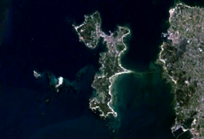
 Satellite image of the Illa de Arousa
|
||
| coat of arms | Map of Spain | |

|
|
|
| Basic data | ||
| Autonomous Community : | Galicia | |
| Province : | Pontevedra | |
| Coordinates | 42 ° 33 ′ N , 8 ° 52 ′ W | |
| Height : | 9 msnm | |
| Area : | 6.92 km² | |
| Residents : | 4,926 (Jan 1, 2019) | |
| Population density : | 711.85 inhabitants / km² | |
| Postal code : | 36626 | |
| Municipality number ( INE ): | 36901 | |
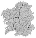
| Location of the municipality | ||

|
||
A Illa de Arousa (official name in Galician language , Spanish La Isla de Arosa ) is also known as A Illa known island in the center of the Ria de Arousa and a municipality in the province of Pontevedra , Galicia ( Spain ).
geography
Arousa has an area of 7 km². The 4926 inhabitants (as of January 1, 2019) mostly live in the vicinity of a headland that connects a small peninsula with the rest of the island, on which the highest point of the municipality is located.
Economy and Infrastructure
The island is connected to the continent by a bridge almost two kilometers long. This is one of the longest bridges in Spain and when it was completed in 1985 it boosted the local economy. Before that, crossings and transports had to be carried out with small steamboats at set times.
The island's economy is still mainly based on fishing and the cultivation of mussels , but tourism is increasingly providing important income.
The main ports are the Puerto do Cantiño and the landing stages of O Campo, Chazo and Cabodeiro.
administration
Due to pressure from its neighbors, Arousa has had its own local government since 1995 . Today it forms the youngest municipality in Galicia and the only one on an island.
Attractions
The main attractions are the area around the lighthouse , the island Areoso in the direct vicinity of Arousa and the National Park of Carreirón , among other things because of its gray heron regarded as a special bird sanctuary populations. The entire area can be seen from the highest point on the island, the Mirador del Santo (viewpoint of the saint).
The European Union has declared Arousa a nature reserve because of its 36 kilometers of coastline (11 km of which are white sandy beaches).
Personalities from the Illa de Arousa
- Ramón Búa Otero (1933–2012), Roman Catholic bishop
Web links
Individual evidence
- ↑ Cifras oficiales de población resultantes de la revisión del Padrón municipal a 1 de enero . Population statistics from the Instituto Nacional de Estadística (population update).
