Vilagarcía de Arousa
| Vilagarcía de Arousa | ||
|---|---|---|
 View of Vilagarcía de Arousa from Monte Lobeira
|
||
| coat of arms | Map of Spain | |

|
|
|
| Basic data | ||
| Autonomous Community : |
|
|
| Province : | Pontevedra | |
| Coordinates | 42 ° 36 ′ N , 8 ° 46 ′ W | |
| Area : | 44.24 km² | |
| Residents : | 37,456 (Jan 1, 2019) | |
| Population density : | 846.65 inhabitants / km² | |
| Postal code : | 36600 | |
| Municipality number ( INE ): | 36060 | |
| administration | ||
| Website : | www.vilagarcia.es | |
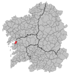
| Location of the city | ||

|
||
Vilagarcía de Arousa ( Spanish Villagarcía de Arosa ) is a Galician city in the province of Pontevedra in northwestern Spain with 37,283 inhabitants (as of 2016).
geography
Vilagarcía de Arousa is located in the Comarca O Salnés on the Ría de Arousa . Neighboring communities are Catoira in the north, Caldas de Reis in the east and Vilanova de Arousa in the south. The provincial capital Pontevedra is 25 km away in the south, Santiago de Compostela is in the northeast and is almost 50 km away.
Population development

sons and daughters of the town
- Marcelino García Pérez (1937-2020), football player
- Pepe Rubianes (1947–2009), actor
- Dani Abalo (* 1987), soccer player
- Gustavo César Veloso (* 1980), racing cyclist
Web links
Commons : Vilagarcía de Arousa - Collection of images, videos and audio files
- Vilagarcía de Arousa website
Individual evidence
- ↑ Cifras oficiales de población resultantes de la revisión del Padrón municipal a 1 de enero . Population statistics from the Instituto Nacional de Estadística (population update).
