Aartalsee
| Aartalsee | |||||||||
|---|---|---|---|---|---|---|---|---|---|
|
|||||||||
|
|
|||||||||
| Coordinates | 50 ° 41 ′ 50 " N , 8 ° 28 ′ 30" E | ||||||||
| Data on the structure | |||||||||
| Construction time: | 1984-1991 | ||||||||
| Height above valley floor: | 14 m | ||||||||
| Height above foundation level : | 15 m | ||||||||
| Height of the structure crown: | 272.5 m above sea level NN | ||||||||
| Building volume: | 90,000 m³ | ||||||||
| Crown length: | 270 m | ||||||||
| Crown width: | 6 m | ||||||||
| Slope slope on the air side : | 1: 2 | ||||||||
| Slope slope on the water side : | 1: 1.8 | ||||||||
| Power plant output: | 0.25 MW | ||||||||
| Data on the reservoir | |||||||||
| Altitude (at congestion destination ) | 270 m above sea level NN | ||||||||
| Water surface | 57 ha (93.5 ha with maximum filling both lakes together) | ||||||||
| Storage space | 4.085 million m³ | ||||||||
| Catchment area | 60.5 km² | ||||||||
| Design flood : | 75 m³ / s | ||||||||
| Map of the Aartalsee | |||||||||
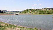
The Aartalsee is located in the upper Aartal in the communities of Bischoffen and Hohenahr in the Lahn-Dill district , north of the district town of Wetzlar and northwest of Gießen in Hesse . In addition to the core town of Bischoffens, the villages of Ahrdt and Mudersbach are directly on the lake; both belong to the community of Hohenahr. The dam has dammed the Aar , a left tributary of the Dill in the Gladenbacher Bergland, since 1991 . Inflows to the reservoir are: Stadterbach, Wilsbach (to the pre-basin), Weidbach and Meerbach (to the main basin).
location
Due to the Aartalsperre, the Aar is dammed in its upper section west of the Niederweidbach basin and forms an artificially created lake in the southern Gladenbacher Bergland .
Via the federal highway 255 , which runs north of the Aartalsperre and runs from the federal highway 45 near Herborn via Gladenbach to Marburg - and thus serves as one of the main routes from the Ruhr area to the university town - is the halfway between Herborn (linear distance 12 km west-southwest) and Gladenbach (11 km north-east) located Aartalsee easy to reach. Marburg in the north-east is about 24 km away as the crow flies, Wetzlar (16 km south) and Dillenburg in the west-north-west, about 14 km away, are connected to the B 255 via the autobahn-like federal road 277 .
In addition, less traveled state roads lead to Wetzlar and Gießen (19 km southeast) and into the Hessian hinterland , to which Bischoffen historically belonged. Biedenkopf in the north is around 24 km away.
use
The dam is mainly used for flood protection for the Aar and Dill. In winter the dam is filled with 1.33 million m³, in summer it is 1.84 million m³. Other uses are low water elevation, power generation, fishing and recreational activities. The dam is intended to stimulate the region economically. The lake was released as a swimming lake in 1992 .
The operator is the district committee of the Lahn-Dill district or the water association “Dillgebiet”.
Main dam
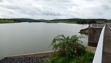
The Aartalsperre dam is a rubble dam made of greywacke and slate rock. At the bottom of the valley, the dam has a height of around 14 m. Its crown width is 6 m, the crown length 270 m.
Extraction facilities
The bottom drainage structure with the flood relief was integrated into the main dam. The water can be taken through four pipes with different diameters. The turbine for generating electricity is also housed here, which is also used to control the water supply from the dam.
Hydropower plant
A flow turbine for smaller water volumes of up to 4 m³ / s is installed in the hydropower plant . Their maximum power is 250 kW. The electricity is not generated all day, but only at times of peak demand. The accumulating water is drained in gushes, which can cause the water level to fluctuate.
Reservoir
The reservoir is relatively shallow, a maximum of 12 m deep, and has a relatively large surface. Some areas of the main basin and the pre-dam were deepened so that a water depth of at least 1.20 to 1.50 m is reached, depending on the water level. Because of its shallow depth, the dammed lake can warm up quickly.
In the event of pollution by organic inputs, eutrophication is easier , that is, a biological "overturning" of the water, for example an algal bloom. In order to counteract the multiplication of cyanobacteria , as few nutrients as possible should get into the water. All places above the dam are therefore connected to a sewer system , which leads the wastewater around the dam to the sewage treatment plant built below at Bischoffen.
Freetime activities
The 82.5 hectare reservoir offers many recreational opportunities on an area of 57 hectares. In addition to a sandy beach for bathing, there are various sunbathing areas, a sailing and surfing club and good opportunities for anglers. The bathing water is checked for its hygienic quality; so far there has been no reason for complaint.
A developed path for pedestrians, joggers, inline skaters and cyclists leads around the lake. In summer the lake is guarded by the German Life Saving Society ( DLRG ).
Pre-lock
The pre-dam has a permanent backlog all year round, which is 2-3 m above the fluctuating water level of the main dam. Since the main barrier is also used for fishing, among other things, and the fish should not migrate into the Vorsperre nature reserve, a fish pass from the main barrier to the Vorsperre was not used.
Two additional areas had to be diked in order to protect the villages of Ahrdt and Mudersbach from flooding. One dam is about 730 m long and about 6.5 m high, the other about 490 m long and 2.5 m high.
natural reserve
The pre-lock is under nature protection . The construction of around twenty islands with different structures and surfaces created a unique nature reserve that is populated by numerous rare bird species. There is also a hiking trail around the pre-dam, from which you can observe the many animals in their natural environment.
Individual evidence
- ↑ see entry Aartal See on the HLNUG website .
See also
Web links
- Aartal See (Hessian State Office for Environment and Geology: Bathing Lakes in Hesse)
- Why the Aartalsee came into being
- Pictures from the Aartalsee


