Aiguille de la Grande Sassière
| Aiguille de la Grande Sassière | ||
|---|---|---|
|
Grande Sassière |
||
| height | 3751 m | |
| location | Dépt. Savoy , France / Aosta Valley , Italy | |
| Mountains | Graian Alps | |
| Coordinates | 45 ° 30 '18 " N , 6 ° 59' 59" E | |
|
|
||
| First ascent | Around 1808 by residents of Tignes (Bertrand Chaudan) and soldiers First officially recorded by William Mathews and Michel Croz on August 5, 1860 |
|
| Normal way | From the Isèretal north of Val-d'Isère via the Barrage du Saut dam (2,260 m) | |
| particularities | Highest Alpine peaks, the hiking can be achieved. | |
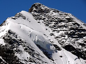
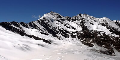
The Aiguille de la Grande Sassière , or often simply the Grande Sassière , is a 3751 m high mountain in the Graian Alps , which lies south of the Mont-Blanc group, or more precisely a little southeast of the pass of the Little Saint Bernard on the ridge, the west and east of this part of the Alps and forms the watershed between the Rhone ( Isère ) and the Po ( Dora Baltea ), and over which the national border between France and Italy runs. This ridge also forms the seam between the Aosta Valley and the historic Savoy in the Savoie department and, a few kilometers further south-east of the mountain, between the two adjacent Gran Paradiso and Vanoise national parks , at the height where, within these protected areas , the northern and The south side of the parks connect: to the west of the Col de l'Iseran Tarentaise (Isère) and Maurienne (Valley of the Arc ), to the east of the Colle del Nivolet, the Aosta Valley and the Orco Valley ( Piedmont ).
Valleys extend from both sides to the foot of the mountain: on the French side, the Grande Sassière dominates the east of the upper Isèretal north of Val-d'Isère and east opposite Tignes . On the Italian side it stands at the head of the (valley of) Valgrisenche .
According to SOIUSA , the Grande Sassière is included in the northern Rutor group (Rutor-Léchaud chain) with the Testa del Rutor , or combined with this to form a massif, the Alpi della Grande Sassière e del Rutor ( Alpes de la Grande Sassière et du Ruitor (Rutor) = Alpes de la haute Tarentaise = Alpes Grées centrales - Central Graian Alps), which is bordered by the three valleys of the Isère, the Valgrisenche and the Dora di Verney from La Thuile (under the Little Saint Bernard).
The normal route does not involve any technical alpine difficulties or glaciated areas, making the Aiguille de la Grande Sassière the highest peak in the Alps that can be reached “hiking”.
Single receipts
- ^ Grand Sassière at summitpost
- ^ WAB Coolidge , The Alps in nature and history , EP Dutton publishers, New York, 1908, p. 398


