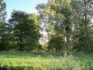
Allerauenwald in Drömling
|
Allerauenwald in Drömling
|
||
| location | North-east of Wolfsburg , in the Lower Saxony district of Helmstedt | |
| surface | 94.7 ha | |
| Identifier | NSG BR 017 | |
| WDPA ID | 81263 | |
| FFH area | 94.7 ha | |
| Bird sanctuary | 94.7 ha | |
| Geographical location | 52 ° 27 ' N , 10 ° 55' E | |
|
|
||
| Sea level | from 57 m to 58 m | |
| Setup date | 2nd February 1979 | |
| administration | NLWKN | |
The Allerauenwald in Drömling is a former nature reserve in the Lower Saxony municipality of Danndorf in the Helmstedt district . The area lies in the sparsely populated valley of the Drömling .
The nature reserve with the registration number NSG BR 017 was 94.7 hectares in size. It was completely part of the FFH area "Drömling" and the bird sanctuary "Drömling". The area has been under nature protection since February 2, 1979. On July 25, 2018, the newly designated nature reserve " Südlicher Drömling " opened. The responsible lower nature conservation authority was the district of Helmstedt.
description
The former Nature Reserve is located northeast of Wolfsburg in the natural area Weser - Aller -Flachland on the southwestern edge of the Drömling, an area of marshland , which for the greater part to Saxony-Anhalt heard and to a lesser extent to Lower Saxony. It is trapezoidal and extended in its longest extent to around 2.3 kilometers. The width of the former nature reserve was almost 500 meters.
The former nature reserve is bounded to the northwest by the straight Aller, to the southwest by the Katharinenbach and to the other sides by ditches and farm roads.
In the former nature reserve, a hardwood alluvial forest grows in which common oak , white elm and common ash predominate. The proportion of old wood is high, the shrub layer is usually well developed. In addition, oak-hornbeam forests , beech forests and pioneer forests mainly made up of birch trees grow . Großseggenriede and reed beds can be found in wet depressions .
history
The area was to the 18th century a barely penetrable swamp in which breakage and riparian forests prevailed. Large parts of the adjacent areas were made arable through amelioration .
In 2002 a major nature conservation project started in the Lower Saxony part of the Drömling, which aimed to improve the water balance in favor of ecological concerns. In the Allerauenwald area, the dam towards the Aller was lowered in some places in 2008 so that the Aller can flood the forest area when the water level is high. In 2009 a flap weir was put into operation on an overflow ditch to the nearby Mittelland Canal . As a result, the water level can be kept high, whereas previously excess water was completely diverted into the Mittelland Canal. In 2011 the area was designated as a natural forest reserve after tree species such as spruce were removed .
literature
- Maintenance and development plan for the nature reserve: Giebelmoor and Aller-Auenwald. Lower Saxony Forest Planning Office Wolfenbüttel, 1989.
Web links
Individual evidence
- ↑ a b c nature reserve "Allerauenwald im Drömling" ( Memento from June 30, 2015 in the Internet Archive ), Lower Saxony State Agency for Water Management, Coastal Protection and Nature Conservation .
- ^ Large-scale nature conservation project in Lower Saxony Drömling , Gifhorn district. Retrieved August 17, 2018.
- ↑ Allerauenwald - Measures of the large-scale nature conservation project Lower Saxony Drömling , Gifhorn district. Retrieved August 17, 2018.
- ↑ a b Martin Zenk: Large-scale nature conservation project in Lower Saxony Drömling ( memento from April 19, 2012 in the Internet Archive ), NABU district association Gifhorn.
- ↑ Allerauenwald , district of Gifhorn. Retrieved August 17, 2018.


