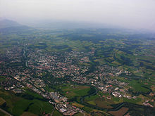
Allgäu cycle path
The Allgäu-Radweg is an approximately 156 kilometer long traffic route through the alpine foothills of the Allgäu and Upper Bavaria . The Burgus Ahegg is a small Roman military camp which , as a late antique residential and watchtower, was responsible for the control of a section of the imperial border along the Danube-Iller-Rhein-Limes (DIR). The remains of the facility that have been excavated and can be viewed are located in the Ahegg district of Markt Buchenberg .


Route
The Allgäu cycle path starts in Isny and leads through Weitnau and Buchenberg via Kempten to Wildpoldsried and Unterthingau . Larger route locations are the cities of Marktoberdorf and Kaufbeuren . Via the Upper Bavarian Schongau , Peiting and Steingaden , you finally get to the destination Halch in the Ostallgäu district.
Elevation profile
Most of the Allgäu cycle path runs on former railway lines or roads through the Alpine foothills , including the former Kempten – Isny railway line . The film Waller's last course was shot mainly on the former Allgäu railway line Kempten-Isny, today's Allgäu cycle path. Shortly after filming, the track systems on this route were dismantled (in 1988 and 1989), thus creating the basis for the current cycle path. Over 1600 meters of altitude have to be overcome along the entire route. There is an ascent between Wildpoldsried and Unterthingau .
character
The Allgäu cycle path can be used by mountain bikes , touring bikes, trekking bikes, electric bikes and families with children. However, longer sections are not paved, so the route is difficult for racing bikes.
The signage is guaranteed throughout.
In places there are views of the Allgäu Alps, here at Ermengerst . The Allgäu cycle path also runs through the town on the railway line.
The Herrenwieser Weiher is right next to the bike path.
From Marktoberdorf you can see the Ammer Mountains .
Connectivity
- Iller cycle path in Kempten
- Via Claudia Augusta from halfchurch
cards
- ADFC regional map, Allgäu cycling map , scale 1: 75,000, Memmingen, Kaufbeuren, Kempten, Bregenz, Bielefelder Verlag , Bielefeld, ISBN 978-3-87073-246-2
- Allgäu cycle tour map - with excursion destinations, refreshment stops and leisure time tips , sheet 309, scale 1: 50,000, Verlag Publicpress , Geseke, ISBN 3-89920-111-6 (with a brief description of the Allgäu cycle path on the reverse)
- Bavaria network for cyclists , cycle network map on a scale of 1: 625,000 based on the overview map of Bavaria 1: 500,000, ed. from the Bavarian State Ministry of the Interior, Ministry for Economy, Infrastructure, Transport and Technology , Munich 2005, ISBN 3-910088-95-3


