Annaberger Bach
| Annaberger Bach | ||
|
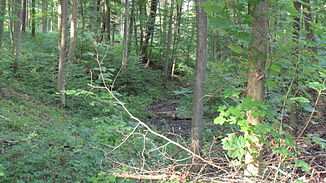
The Annaberg Bach in its upper course |
||
| Data | ||
| Water code | DE : 2719712 | |
| location | Bonn , North Rhine-Westphalia , Germany | |
| River system | Rhine | |
| Drain over | Rhine → North Sea | |
| source | north of the forester's house Venne 50 ° 40 ′ 56 ″ N , 7 ° 6 ′ 51 ″ E |
|
| Source height | 175 m above sea level NHN | |
| muzzle | At the Konrad-Adenauer-bridge in the Rhein (Km 651.44) coordinates: 50 ° 42 '59 " N , 7 ° 8' 31" O 50 ° 42 '59 " N , 7 ° 8' 31" O |
|
| Mouth height | 47 m above sea level NHN | |
| Height difference | 128 m | |
| Bottom slope | 23 ‰ | |
| length | 5.5 km | |
| Catchment area | 6,188 km² (including Gieveningsbach) | |
| Drain |
MHQ |
1640 m³ / s |
| Big cities | Bonn | |
|
Confluence of the Annaberger and Gieveningsbach |
||
|
The Annaberger Bach flows into the Rhine |
||
The Annaberger Bach is a five kilometer long left tributary of the Rhine in Bonn , which flows through the districts of Friesdorf , Hochkreuz and Gronau .
course
Like all streams on the eastern slope of the southern Ville, the Annaberger Bach drains the main terrace there , which consists mainly of Rhine gravel and is covered with a soil layer of Kotten forest clay, which is known as regional.
In the pond southwest of the Rheinhöhenweg mainly seasonal surface runoff collects , which is dammed here under average weather conditions. The existing overflow of the pond is rarely reached. After crossing the Rheinhöhenweg, caused by deep erosion , the valley of the Annaberger Bach begins . In this area the stream often falls dry. The section of the valley in which the brook is steadily flowing through the outlet of seepage springs begins approx. 100 m below the pond in the source area. From there the brook runs northwards, while the valley deepens and the water flow increases rapidly due to tributaries that flow on the left.
In its further course, the brook meets the Gieveningsbach in Friesdorf at the beginning of the settlement area in Annaberger Straße , before it disappears into the piping at a scree and flood retention basin . In this it then runs below Annaberger Straße, Im Bachele and Im Wiesengrund until it connects to the Winzerbach at the end of a pedestrian bridge . From there, the Annaberger Bach flows, apart from a few piping, in a naturally designed brook bed within green areas to the northeast until it joins the Klufterbach at the confluence of the Am Schwalbengarten street with Bernkasteler Straße . The rest of the course continues while maintaining the previous water structure past the former United Nations Square through the Park Hain der Nations (completed in 1994) until the stream north of the Robert-Schuman-Platz underground station is again channeled underground (drainage canal from 1974 ) and finally - changed to the west side of the federal motorway 562 - flows into the Rhine at the Konrad-Adenauer-Brücke .
The stream flows through the settlement area partly piped and partly open. Above the scree basin in Annaberger Straße, it naturally runs through a deciduous forest. The water quality above the flood retention basin is I-II, in the open areas within the settlement area II.
particularities
By June 2000 the brook was fed into the mixed water sewer system. The removal from this happened in the course of the implementation of the WFD and to relieve the Bad Godesberg sewage treatment plant .
The valley section above the flood retention basin is not accessible by paths and is difficult to access. As a result, the water ecology is hardly disturbed there.
Web links
Remarks
- ↑ The Waters Directory of the LANUV, TIM-online and the Bach Development Plan of the City of Bonn indicate different sources, courses and water lengths for the Annaberg Bach. According to TIM-online, the stream rises north of the Annaberger Hof and is therefore only five kilometers long. The Gieveningsbach was probably incorrectly documented here. The history on the linked OSM map corresponds to this article.
Individual evidence
- ↑ a b District map No. 48, 1: 50000, Rhein-Sieg-Kreis u. City of Bonn
- ↑ a b Bach Development Plan 2008 , City of Bonn (PDF; 1.65 MB)
- ↑ Water directory of the State Office for Nature, Environment and Consumer Protection NRW 2010 (XLS; 4.67 MB) ( Notes )
- ↑ Documentation by the Bonn City Building Authority from June 22, 2001: The Annaberger Bach and its tributaries .
- ↑ Water quality map of the city of Bonn, 3rd edition


