Cut out
| Cut out | ||
| Data | ||
| location | District of Göttingen , Lower Saxony ( Germany ) | |
| River system | Weser | |
| Drain over | Sultry → Weser → North Sea | |
| source | on Brunsberg and Hengelsberg in the Dransfeld city forest 51 ° 28 ′ 49 ″ N , 9 ° 45 ′ 15 ″ E |
|
| Source height | approx. 411 m above sea level NHN | |
| muzzle | near Eberhausen in the Schwülme Coordinates: 51 ° 34 ′ 19 ″ N , 9 ° 42 ′ 51 ″ E 51 ° 34 ′ 19 ″ N , 9 ° 42 ′ 51 ″ E |
|
| Mouth height | approx. 165 m above sea level NHN | |
| Height difference | approx. 246 m | |
| Bottom slope | approx. 17 ‰ | |
| length | 14.3 km | |
| Left tributaries | Lamfertbach | |
| Small towns | Dransfeld | |
| Communities | Eberhausen | |
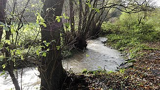
The Auschnippe is a 14.3 km long, southern and orographically left tributary of the Schwülme in the southern Lower Saxony district of Göttingen .
The stream rises in the low mountain range of Dransfeld Stadtwald . Its source is located north-northwest of the Hohen Hagen (approx. 492.5 m above sea level ) from a source each on the western slope of Brunsberg ( 480.2 m ) and on the eastern slope of Hengelsberg ( 463 m ). The resulting source streams unite after a few hundred meters of flow. The altar stones near Dransfeld are located a little south of the source area .
The Auschnippe leaves the Dransfeld city forest flowing in a northerly direction and then runs through Dransfeld , where it passes under the federal highway 3 and the Dransfelder ramp (section of the former route of the Hanoverian southern railway ). Continuing to flow towards the north, it passes Güntersen in the west and Barterode in the east (districts of Adelebsen ) without flowing through these localities directly. The Upper , Middle and Lower Auschnippemühle stand by the stream between the two villages . Below these mills of Bach happened east-northeast of Adelebsen- Eberhausen the paper mill Eberhausen .
A little further north-north-west, the Auschnippe flows into the Schwülme , an eastern tributary of the Oberweser, about 3 km west-southwest of Adelebsen on state road 554, after crossing the Göttingen – Bodenfelde railway line ( Oberweserbahn ) .
Individual evidence
- ↑ a b c Topographic map of the Auschnippe source area ( memento of the original from September 10, 2014 in the Internet Archive ) Info: The archive link was inserted automatically and has not yet been checked. Please check the original and archive link according to the instructions and then remove this notice. ( LGLN , DTK 25; see large enlargement of the map), on natur-erleben.niedersachsen.de
