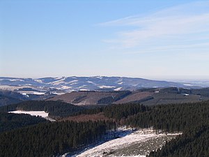
Balver Forest
| Balver Forest | ||
|---|---|---|
|
Balver Forest from the southeast ( Schomberg observation tower ) |
||
| height | 546.2 m above sea level NHN | |
| location | Sauerland-Rothaargebirge Nature Park , Märkischer Kreis , Sauerland , North Rhine-Westphalia | |
| Mountains | Iserlohner Höhe , Märkisches Oberland , Süderbergland | |
| Dominance | 13.7 km → Denstenberg ( 560 m , Lennegebirge ) | |
| Notch height | 187 m ↓ near Hexentanzplatz southeast of Neuenrades | |
| Coordinates | 51 ° 21 '18 " N , 7 ° 49' 44" E | |
|
|
||
The Balver forest is 546.2 m above sea level. NHN the highest elevation of the Iserlohner Höhe as well as of the entire Märkische Oberland in the Sauerland of the Brandenburg region . It is located in the northwest of the Sauerland-Rothaargebirge nature park on the city limits between Balve and Hemer .
The mountain is named after the forest area of the same name north-west of Balves, in which it is only located in the south-eastern half.
Within the Iserlohner Höhe natural area , the mountain is located in the northeast of the central Ihmerthochfläche and not, as one might think, in the area of its eastern slope, the Balver Wald and Küntrop Mountains .
Location and limits
The mountain Balver Wald is located west of the Hönne overflow, in the center of the Märkisches Kreis .
The core town of Iserlohn is a good 8 km west-northwest, the Hemers 5 km north-west. In the north, Hüingsen is 6 km away, in the south-east the core town of Balves is around 3.5 km and in the south-south-west the Neuenrades is a good 7 km. Hemer- Ihmert is 6 km to the southwest.
The surrounding forest area
The Balver Forest was used intensively for acorn fattening in earlier times , with the pig pound being organized collectively. Another important form of use was charcoal burning . The Balver Forest was the venue for serious disputes between the surrounding villages.
Important waymarks in the area are “Krause Buche”, “Handweiser” and “Kreuzeiche” - all on the old “Höhweg”.
Since the hurricane Kyrill , the Balver Forest has been largely destroyed, especially at high altitudes.
Individual evidence
- ↑ The watershed is only minimally below the 360 m height line near the Hexentanzplatz
- ↑ Topographical Information Management, Cologne District Government, Department GEObasis NRW ( Notes )
- ↑ Geographical survey of the country: The natural units on sheet 110 - Arnsberg (Martin Bürgener 1969) - Federal Institute for Regional Studies, Bad Godesberg (→ maps )
- ↑ Map services of the Federal Agency for Nature Conservation ( information )

