Himert
|
Himert
City of Hemer
|
|
|---|---|
| Coordinates: 51 ° 19 ′ 49 ″ N , 7 ° 44 ′ 10 ″ E | |
| Height : | 364 m above sea level NN |
| Area : | 11.42 km² |
| Incorporation : | 1st January 1975 |
| Postal code : | 58675 |
| Area code : | 02372 |
|
Location of the former Ihmert municipality in Hemer
|
|
|
Look at him
|
|
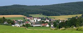
Ihmert is a district of Hemer in North Rhine-Westphalia , Germany . Ihmert is located in the north of the Sauerland and belongs to the Märkisches Kreis .
geography
Ihmert is in the south of Hemer, on the city limits to Altena and Iserlohn . The village is one of the highest points in the city.
history
The village was a municipality in the office Hemer in the former district of Iserlohn and was incorporated into the city of Hemer when the office was dissolved on January 1, 1975.
politics
mayor
- 1902–1907: Hermann Lötters
- 1907–1917: Caspar Diedrich Erdmann
- 1917–1919: Heinrich vom Brauke
- 1919–1934: Ernst Hagedorn (DDP, later NSDAP)
- 1934–1945: Carl Edelhoff (NSDAP)
- 1946–1948: Hans-Heinrich vom Brauke (CDU)
- 1948–1952: Otto Hülter (CDU)
- 1952–1955: Fritz vom Orth (SPD)
- 1955–1961: Günther Schweer (FDP)
- 1961–1965: Friedrich Ossenberg (FDP)
- 1965–1967: Rudolf Machelett (SPD)
- 1967–1969: Adolf Hülter (FDP)
- 1969–1972: Rudolf Machelett (SPD)
- 1972–1974: Egon Stephan (SPD)
Town twinning
Since 1968 there has been a town partnership between Ihmert and the French town of Beuvry , which is regularly maintained through mutual visits.
coat of arms
The coat of arms of the former municipality of Ihmert shows a so-called drawing iron above , with which the wire drawing in the municipality is to be symbolized. Wire drawing is and was one of the main industries in the region. The three wolf fishing rods, which all parishes in the Hemer office had in their coat of arms, symbolize the von Brabeck family .
Web links
- Private website about him
- Ihmert in the Westphalia Culture Atlas
Individual evidence
- ^ Federal Statistical Office (ed.): Historical municipality directory for the Federal Republic of Germany. Name, border and key number changes in municipalities, counties and administrative districts from May 27, 1970 to December 31, 1982 . W. Kohlhammer, Stuttgart / Mainz 1983, ISBN 3-17-003263-1 , p. 333 .


