Bantay
| Municipality of Bantay | ||
 |
||
| Location of Bantay in the province of Ilocos Sur | ||
|---|---|---|

|
||
| Basic data | ||
| Region : | Ilocos region | |
| Province : | Ilocos Sur | |
| Barangays : | 34 | |
| District: | 1. District of Ilocos Sur | |
| PSGC : | 012903000 | |
| Income class : | 4. Income bracket | |
| Households : | 6107 May 1, 2000 census
|
|
| Population : | 35,731 August 1, 2015 census
|
|
| Coordinates : | 17 ° 35 ' N , 120 ° 23' E | |
| Postal code : | 2727 | |
| Area code : | +63 77 | |
| Mayor : | Samuel C. Parilla | |
| Website: | www.bantay.gov.ph | |
| Geographical location in the Philippines | ||
|
|
||
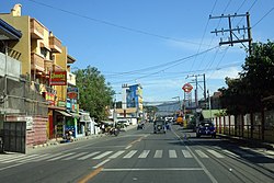
Bantay is a municipality in the Philippine province of Ilocos Sur . Bantay was founded by the Spaniards and built up by the Augustinians . The community also has an old Spanish church and a park rich in plants. One of the most important structures in Bantay, the Quirino Bridge , which spanned the Abra , was destroyed in a devastating flood in 2001.
Barangays
Bantay is divided into the following 34 barangays :
|
|
|
