
Basel-Clara
|
Clara Quartier of Basel |
|
|---|---|
 |
|
| Coordinates | 611 831 / 268 174 |
| surface | 0.24 km² |
| Residents | 4082 (December 31, 2018) |
| Population density | 17,008 inhabitants / km² |
| BFS no. | 2701-013 |
| Post Code | 4058 |
Clara ( called Gloore or Glaare in Basel German ) is a district of the Swiss city of Basel . It is located east of the Kleinbasel city center and borders in the north on the Matthäus district (Sperrstrasse), in the east on the Rosental district (Riehenring), in the south on the Wettstein district (Riehenstrasse) and in the west on the Kleinbasel old town (Klybeckstrasse, Claragraben).
With around 23.66 hectares, the Clara Quarter is the smallest district of Basel. It is named after the Clarakirche and the Claraplatz in front of it, which were part of the former St. Clara monastery there.
Residential districts
Clara is divided into two residential areas:
- Claramatte (Klingentalstrasse, Hammerstrasse)
- Clarahof (Clarahofweg, Hammerstrasse)
Buildings and landmarks
- Clarakirche and former Clarakloster
- Claramatte (Park)
- Claraplatz opposite the Clarakirche, with buildings from the 1950s, green space and a cast-iron weather house
- monumental wall painting «Fingerprint» by Jean-Pierre Zangger (1982) at the police station at Clarastrasse 38
_beim_Polizeiposten_an_der_Clarastrasse_38,_Basel-Clara.jpg)
gallery

St. Clara's Church

Weather house on Claraplatz
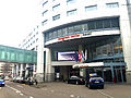
Congress Center Basel
.JPG)
.JPG)

Web links
Old Town Grossbasel | Old town of Kleinbasel | At the ring | Bachletten | Width | Bruderholz | Clara | Gotthelf | Gundeldingen | Hirzbrunnen | Iselin | Kleinhüningen | Klybeck | Matthew | Rose Valley | St. Alban | St. Johann | Suburbs | Wettstein