Big Sand Cay
| Big Sand Cay | ||
|---|---|---|
| Waters | Atlantic Ocean | |
| Archipelago | Turks Islands | |
| Geographical location | 21 ° 11 '33 " N , 71 ° 14' 55" W | |
|
|
||
| length | 2.5 km | |
| width | 200 m | |
| surface | 58 ha | |
| Residents | uninhabited | |
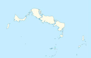
| Big Sand Cay location map (bottom right) | ||
Big Sand Cay is the southernmost island of the Turks Islands and is part of the British overseas territory of the Turks and Caicos Islands . It is located about 11 km south of the southern tip of Salt Cay .
The elongated Big Sand Cay is flat and barely overgrown. The island is uninhabited.
swell
- Sailing Directions 2004 Caribbean Volume 1 Enroute, Volume 1, Pages 35/36

