
South Caicos
| South Caicos | ||
|---|---|---|
 |
||
| Waters | Atlantic Ocean | |
| Archipelago | Caicos Islands | |
| Geographical location | 21 ° 30 '34 " N , 71 ° 31' 4" W | |
|
||
| length | 9.87 km | |
| width | 5.49 km | |
| surface | 21.2 km² | |
| Highest elevation | 30 m | |
| Residents | 1139 (2012) 54 inhabitants / km² |
|
| main place | Cockburn Harbor | |

South Caicos is the southeasternmost island of the Caicos Islands and belongs to the British overseas territory of the Turks and Caicos Islands .
The mostly flat island with an area of about 21 square kilometers and the shape of a tobacco pipe is about ten kilometers south of East Caicos ; there are still some uninhabited sand islands between the two islands. Upstream of the southwest tip is the narrow Long Cay .
On the south coast of South Caicos there is also the main town Cockburn Harbor . There and in the few other settlements on the island (Out North and Highlands) lived 1139 people according to the 2012 census .
South Caicos has a fortified natural harbor and South Caicos Airport .
The marine area around the island is a popular destination for deep-sea anglers and scuba divers .
Picture gallery

Main town Cockburn Harbor
Residence of the commissioners

Residential buildings on
South Caicos
South Caicos coast
Sailing off
South Caicos
Scuba divers off
South Caicos
Queen's Parade Ground
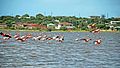
Flamingos on
South Caicos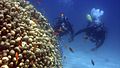
Coral reef of
South Caicos


literature
- HE Sadler, Marjorie Sadler, Karen Collins: Turks Islands Landfall. A History of the Turks & Caicos Islands . Marjorie E. Sadler, Grand Turk - Turks and Caicos Islands 1997, ISBN 976-8138-62-9 .
Web links
- Website of the Turks and Caicos Islands to South Caicos (English)
- Welcome to South Caicos! In: visittci.com. Visit Turks and Caicos Islands Limited.
Individual evidence
- ^ Physical Characteristics. Land areas of the Turks and Caicos Islands. Department of Economic Planning and Statistics, Government of Turks and Caicos, archived from the original on March 25, 2009 ; accessed on December 3, 2018 .
- ↑ 2012 Population and Housing Census - Preliminary Report. (PDF; 1.69 MB) In: caribbeanelections.com. KnowledgeWalk Institute, p. 26 , accessed December 3, 2018 .
Turks Islands : Grand Turk | Salt Cay | Cotton Cay | East Cay | Gibbs Cay | Big Sand Cay
Caicos Islands : West Caicos | Providenciales | Water Cay | Pine Cay | Stubbs Cay | Fort George Cay | Dellis Cay | Parrot Cay | North Caicos | Middle Caicos | East Caicos | South Caicos | Long Cay | Ambergris Cays ( Big Ambergris Cay | Little Ambergris Cay )