Big Thompson River
| Big Thompson River | ||
|
The Big Thompson River in Viestenz-Smith Park |
||
| Data | ||
| Water code | US : 205019 | |
| location | Colorado (USA) | |
| River system | Mississippi River | |
| Drain over | South Platte → Platte → Missouri → Mississippi → Gulf of Mexico | |
| source | in Rocky Mountain National Park 40 ° 25 ′ 41 ″ N , 105 ° 47 ′ 29 ″ W |
|
| Source height | 3447 m | |
| muzzle | in the South Platte River coordinates: 40 ° 21 ′ 16 " N , 104 ° 45 ′ 37" W 40 ° 21 ′ 16 " N , 104 ° 45 ′ 37" W. |
|
| Mouth height | 1423 m | |
| Height difference | 2024 m | |
| Bottom slope | 16 ‰ | |
| length | 126 km | |
| Drain at Loveland gauge |
NNQ MQ HHQ |
10 l / s 2.05 m³ / s 120.06 m³ / s |
| Left tributaries | North Fork Big Thompson River | |
| Right tributaries | Little Thompson River | |
| Reservoirs flowed through | Lake Estes | |
| Medium-sized cities | Loveland , Greeley | |
| Communities | Estes Park | |
| Navigable | No | |
|
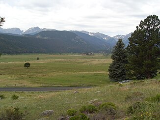
Big Thompson River in Valley Moraine Park in Rocky Mountain National Park |
||
|
Sign in Viestenz-Smith Park showing the maximum height of the Big Thompson River flood and the hydropower plant's turbines destroyed by the flood |
||
The Big Thompson River is about 126 kilometers long left tributary of the South Platte River in the County's Weld County and Larimer County in the state of Colorado in the USA .
course
The river, which is sometimes also referred to as the Pipe River , which is fed by two arms, has its source region in the Front Range , part of the Rocky Mountain National Park , in Larimer County. The northern arm rises from the northern slope of the Mummy Range . It flows through the town of Glen Haven in an easterly direction and after about 13 kilometers in a south-easterly direction reaches the town of Drake . The southern arm rises in Forest Canyon , it flows east through the Moraine Park valley in Rocky Mountain National Park and through the city of Estes Park , where it is dammed to Lake Estes . After passing Olympus Dam , it flows through Big Thompson Canyon , where the two arms of the river join in Drake.
After the Big Thompson River leaves Big Thompson Canyon, it reaches the city of Loveland at the foot of the Rocky Mountains . It then crosses the Great Plains towards Greeley , unites with the Little Thompson River , before flowing into the South Platte River about 8 kilometers south of Greeley.
Big Thompson River water management is carried out by the Northern Colorado Water Conservancy District as part of the Colorado Big Thompson Project , a major project for the utilization of natural water resources in Colorado.
The Big Thompson Canyon flood of 1976
On July 31, 1976, Big Thompson Canyon was hit by a tidal wave from the Big Thompson River caused by a relatively stationary thunderstorm nearby. During this thunderstorm, up to 300 millimeters of rain fell locally within about 4 hours. This is more than three quarters of the region's mean annual rainfall. At around 9 p.m. the water level in the river rose to a height of over 6 meters, and the water flowed downhill at a speed of around 6 meters per second. At this point in time, the river had a discharge rate of up to 1000 m³ per second, four times more than has ever been recorded. A total of 143 people were killed by the tsunami, five of them were never found again, 400 cars and 418 houses were destroyed. Furthermore, US Highway 34 , which runs parallel to the river, was largely destroyed by the flood and debris. In Viestenz-Smith Park , a popular excursion destination east of Drake, which was also destroyed that day , the ruins of the former hydroelectric power station and the generators can still be seen today. The power station had been producing electricity on the banks of the Big Thompson River from 1925 until the flood. The park has since been rebuilt, but not the power station.
Web links
Individual evidence
- ↑ Big Thompson River ( June 24, 2008 memento on the Internet Archive ), The Columbia Gazetteer of North America. 2000.
- ↑ Water Data Report, Colorado 2003 (PDF; 3.9 MB), from Water Resources Data Colorado Water Year 2003 , USGS .
- ↑ Big Thompson River in the United States Geological Survey's Geographic Names Information System
- ^ [1] NOAA: Colorado remembers big Thompson Canyon flash flood of 1976
- ↑ D. Hyndman and D. Hyndman, Natural Hazards and Disasters (Thomson Brooks / Cole, 2006), 270-271


