Bordesholmer See
| Bordesholmer See | ||
|---|---|---|

|
||
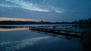
| Dusk on the lake | ||
| Geographical location | In the heart of Schleswig-Holstein | |
| Tributaries | Kalbach et al. another 4 trenches | |
| Drain | Stintgraben → Upper Eider | |
| Places on the shore | Bordesholm | |
| Data | ||
| Coordinates | 54 ° 10 ′ 19 ″ N , 10 ° 1 ′ 4 ″ E | |
|
|
||
| Altitude above sea level | 25.79 m above sea level NN | |
| surface | 70.8 ha | |
| length | 1.15 km | |
| width | 810 m | |
| volume | 2.32 million m³ | |
| scope | 4.9 km | |
| Maximum depth | 8.0 m | |
| Middle deep | 3.28 m | |
| Catchment area | 13.92 km² | |
The Bordesholmer See is a lake in Schleswig-Holstein in close proximity to the municipality of Bordesholm .
location
The lake lies in the area of the Rendsburg-Eckernförde district and was formed as a subglacial drainage valley during the Vistula Ice Age . There are no significant tributaries; for this reason the lake is mainly fed by groundwater and precipitation. An artificial tributary is the stone ditch that feeds water from the Einfelder See . The lake is drained via the northeast lying Stintgraben , which flows over the mill pond of the Schmalsteder Mühle to the Eider.
The lake is closed to motor boats. There is a bathing establishment on the east side. You can walk around the lake in around an hour, around 80% of which is on a hiking trail away from the roads.
Origin and settlement
After the ice caps melted over Northern Germany during the last Ice Age , the lake landscapes in Holstein were created around 15,000 years ago . At that time, the Bordesholmer Land consisted mainly of large water and swamp landscapes, from which the Einfelder See, the Dosenmoor and the Bordesholmer See later emerged.
From around 9000 BC There are first indications of the presence of Paleolithic hunters and gatherers on the shores of the lake. From around 5000 BC BC people settled on Lake Bordesholmer.
Around 1700 BC One of the largest North German settlements of the Bronze Age arose here . Testimonials from this time are u. a. the megalithic tombs and the Brautberg , a Bronze Age urn hill, on which over 5000 urns were buried up to 500 AD.
history
In 1148 the settlement of Eiderstede on the banks of the Bordesholmer See was mentioned for the first time. In 1330 the canons of Neumünster moved to the island in the Bordesholmer See. The new monastery and the associated monastery church were built there.
The name Bordesholm originated from the monks' settlement information. First written record as Bardesholm (1302), Bard = mnd. Bank and stile = mnd. Island.
In the course of the Thirty Years' War, the monastery school and the library of the Bordesholm Augustinian monastery were relocated to Kiel in 1665, where they formed the basis of today's Christian Albrechts University . In 1666 the Brüggemann Altar from Bordesholm was moved to the Schleswig Cathedral .
For the construction of the Eider Canal , a possible route from Kiel to the Lower Elbe , which led through the Bordesholmer See, was examined in 1774 . The glacial channel from Obereider, Bothkamper , Bordesholmer and Einfelder See should be used for this. After the watershed at Einfelder See, the Lower Elbe would have been reached via the two rivers Schwale and Stör .
use
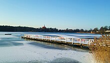
On the east side of the Bordesholmer See there is a public swimming pool with a small beach. The 52 m long pier with the 6 × 6 m bathing platform was rebuilt in 2012.
The building of the bathing establishment with shower and changing rooms partially burned down in October 2012. It has now been rebuilt and opened in July 2014 under the name “Seeterrassen”. It includes a kiosk, a guest room, a room for the lifeguards of the DLRG and sanitary facilities.
A six-kilometer circular path leads around the lake. Every year in September the Bordesholmer See & run lake run takes place. Running and walking routes between 800 m and 17.2 km are used by hundreds of runners.
See also
Individual evidence
- ↑ a b c d Bordesholmer See: Characteristic data . In: Ministry for Energy Transition, Agriculture, Environment and Rural Areas Schleswig-Holstein: Lakes (accessed on August 13, 2012)
- ^ A b c d Brigitte Nixdorf, Mike Hemm, Anja Hoffmann, Peggy Richter: Documentation of the condition and development of the most important lakes in Germany: Part 1 Schleswig-Holstein . Final report R&D project FKZ 299 24 274 on behalf of the Federal Environment Agency, 2004 ( PDF file; 2.1 MB )
- ↑ http://www.neumuenster.de/cms/index.php?article_id=489
- ↑ Bathing water quality at Bordesholmer See
- ^ Manfred Jessen-Klingenberg : The Schleswig-Holstein Canal - Eider Canal. Prehistory, origin, meaning. In: Communications from the Kiel Society for City History . Vol. 85, Issue 3/2010, p. 118


