
Borkener See
| Borkener See | ||
|---|---|---|

|
||
| View over the Borkener See to Borken | ||
| Geographical location | West Hessian valley | |
| Tributaries | Layer springs in the red sandstone | |
| Places on the shore | Nassenerfurth , Trockenerfurth | |
| Location close to the shore | Borken (Hesse) | |
| Data | ||
| Coordinates | 51 ° 2 '5 " N , 9 ° 16' 1" E | |
|
||
| Altitude above sea level | 177 m above sea level NN | |
| surface | 139 ha | |
| length | 1.25 km | |
| width | 780 m | |
| volume | 35,000,000 m³ | |
| Maximum depth | 52.5 m | |
| PH value | 8th | |
| Catchment area | 3.5 km² | |
|
particularities |
oligotrophic , nature reserve , resting place for migratory birds |
|

The Borkener See is an artificial lake that was created in the course of lignite mining in the Borkener lignite area , southwest of Borken in the Schwalm-Eder district in Hesse , Germany . Because of its ecological importance, among other things as a bird resting area, the lake and its banks are under nature protection.
geography
General
The Borkener See lies in the Schwalmaue , part of the West Hessian Basin , and is an important resting place for migratory birds . The water surface is about 177 m above sea level . The area of the lake is approx. 139 ha . Its length is approx. 1250 m and the width approx. 780 m. The town of Borken and the districts of Nassenerfurth and Trockenerfurth border the lake .
Emergence
Emerging from the former lignite open cast mine Altenburg IV , the Borkener See was created in the course of recultivation from 1975 to 1992. During the production period (1954–1975) the operating area of the opencast mine comprised 234 hectares. Approx. 70,000,000 m³ of overburden were moved to extract around 9 million tons of lignite.
In the initial phase of recultivation, considerations were made as to whether the filling of the Borkener See should not be accelerated in order to be able to use it as a leisure area with weekend houses. During investigations at the beginning of the filling it turned out, however, that the lake was slightly alkaline and also poor in nutrients (oligotrophic). Thereupon the acceleration of the filling was stopped and the designation of the Borkener See as a nature reserve was initiated.
Dramatic landscape
In the southeastern open-cast mining area, in the area of the former Weingrund underground mine - an area with recurring extensive subsidence and slope slides, around 20 hectares have already been earmarked for designation as a nature reserve. This area was also known as the “dramatic landscape”, as the fauna and flora in this area had to constantly adapt to new conditions.
Wetland
In addition, a wet biotope with an area of approx. 5 hectares was created in the north of the lignite opencast mine . Particular emphasis was placed on a long shoreline with a length of approx. 1.3 km and just 2.6 hectares of water.
use
The entire catchment area of the Borkener See is under nature protection. The Federal Republic of Germany and the State of Hesse have jointly bought the land in question through the " Hessischer Naturschutz " foundation . This was to prevent nutrients from entering the lake through agricultural use.
ecology
Water quality
Unlike most of the larger lakes in Hessen, Lake Borken is oligotrophic. Also, due to its size, it is not to be expected that it will become nutrient-rich (eutrophic). Furthermore, in contrast to similar opencast mines, it has a basic pH value in its “youth” stage . Thus, it provides a refuge for plants and animals that specialize in this habitat .
Protection status
The entire lake, including its shoreline zones, is under nature protection. Bathing, fishing and other water sports activities are therefore not permitted. The approximately 350 hectare nature reserve Borkener See is an important resting area for water birds and waders . A circular hiking trail leading around the lake with several viewpoints invites you to observe nature.
Hydrological data
The catchment area of the Borkener See is about 350 ha including the lake area with 139 ha. The maximum water depth is 52.5 m. Its volume is 35,000,000 m³. The Borkener See is fed by layer springs of the Buntsandstein with 72 l / s (= 104 m³ / daily). The pH fluctuates between 7.5 and 9.

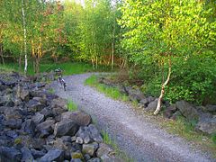
Gravel circular path

High seat on the Borkener See

View of the lake from an observation post


literature
- Magistrate of the city of Borken (Ed.): 675 years of the city of Borken . Contributions to urban development. 1st edition. Riemann, Melsungen 1992.
- Magistrate of the City of Borken (Ed.): Borkener Jubilee Reading Book 775-2000 . Contributions to the history of the city. 1st edition. Magistrat der Stadt Borken, Borken 2000, ISBN 3-932739-08-6 .
Individual evidence
- ↑ Federal Agency for Nature Conservation (Ed.): West Hessian Senke . ( HTML [accessed December 12, 2012]). HTML ( Memento of the original from July 21, 2011 in the Internet Archive ) Info: The archive link was inserted automatically and has not yet been checked. Please check the original and archive link according to the instructions and then remove this notice.
- ↑ a b c d Ute Bergmeier: Nature conservation on the Borkener See . Contributions to urban development. In: Magistrat der Stadt Borken (Ed.): 675 years of the city of Borken . 1st edition. Riemann, Melsungen 1992, p. 52-54 .
- ↑ Hessian State Office for Environment and Geology (Ed.): Borkener See . Master data sheet measuring point. ( HTML [accessed December 8, 2008]).
- ↑ a b c Horst Schönhut: The Borkener See . Contributions to the history of the city. In: Magistrat der Stadt Borken (Hrsg.): Borkener Jubiläums-Lesebuch 775-2000 . 1st edition. Magistrate of the City of Borken, Borken 2000, ISBN 3-932739-08-6 , p. 236-239 .
- ↑ Federal Agency for Nature Conservation (Ed.): Altenburg IV . Borkener See. ( HTML (web archive) ( Memento of November 16, 2010 in the Internet Archive ) [accessed December 12, 2012]). Altenburg IV ( Memento of the original from November 16, 2010 in the Internet Archive ) Info: The archive link has been inserted automatically and has not yet been checked. Please check the original and archive link according to the instructions and then remove this notice.
- ↑ Borkener See . Borkener Seenland. In: Stadt Borken (Hrsg.): Freizeitangebote . ( HTML [accessed January 10, 2016]).
- ↑ standing water . In: Hessisches Landesamt für Umwelt und Geologie (Hrsg.): Umweltatlas Hessen . ( HTML [accessed December 12, 2012]).
- ↑ Borkener See . PH value. In: Hessisches Landesamt für Umwelt und Geologie (Hrsg.): Master data sheet measuring point . ( hlug.de [accessed December 8, 2008]).
Web links
- Website City of Borken to Borkener See
- The NIZ Borkener See. NZH Projekt GmbH, archived from the original on October 26, 2007 ; accessed on January 10, 2016 .
- Environmental Atlas Hesse