
Braunarlspitze
| Braunarlspitze | ||
|---|---|---|
 Braunarlspitze massif |
||
| height | 2649 m above sea level A. | |
| location | Vorarlberg , Austria | |
| Mountains | Lechquellen Mountains | |
| Dominance | 5.5 km → Flour sack | |
| Notch height | 612 m ↓ Oberes Johannesjoch | |
| Coordinates | 47 ° 13 '45 " N , 10 ° 3' 52" E | |
|
||
| Type | Rock peaks | |
| Age of the rock | Main dolomite | |
| First ascent | 1877 by mountain guide Mathias Wüstner from Mellau | |
| Normal way | Schröcken - Fellealpe - Braunarlspitze | |

The Braunarlspitze is the highest peak in the northern half of the Lechquellen Mountains and is therefore particularly noticeable from the Bregenzerwald . The Mellau mountain guide Mathias Wüstner made the first ascent in 1877 over the north ridge.
Valley locations / bases
- Schröcken (near Hochtannbergpass)
- Buchboden in the Great Walsertal
- Biberacher Hut (in the northwest)
- Göppinger Hütte (in the southwest)
- Oberlech (in the southeast)
When climbing as part of a day tour, however, you usually cannot pass these huts.
Ascent
The ascent of the Braunarlspitze over the north ridge from Schröcken is a mountain tour that repeatedly has climbing points (I and I +) in the upper part.
From Schröcken (parking lot behind the church ) you go over the Fellealpe ( snack station ) into the Fellbachtal, cross the stream under the waterfall and climb up to the Hochbergsattel ( Braunarlfürggele , 2145 m). From the Fürggele over the Weimarer Steig in easy climbing (I +), in some places safety devices are attached, and over karst crags to the summit.
The Fürggele can also be reached from the Biberacher Hütte via the Weimarer Steig (3.5 hours from the Schutzhaus to the summit), and from Buchboden via the Fürggeleweg.
The Theodor-Prassler-Weg leads through the southern flank of the Braunarlspitze. This high path connects Oberlech over the Butzensee with the Göppinger hut. From Höhenweg branches off at about 2340 m, a trail leading over rubble and crags without climbing points, which takes you to the summit in an hour. You can also go to this junction from the Lechtal, z. B. from train, ascend.
view
The view includes the Bernina Group , Rätikon , Bernese Alps (e.g. Finsteraarhorn , 167 km, Eiger , Wetterhorn ), Verwall Group , Silvretta , Ötztal Alps (with views of the Stubai Alps ), Lechtal Alps , Wetterstein , Mieminger Mountains , Allgäu Alps , Lechquellen Mountains , Bregenzerwald , Alpstein , Glarus Alps and many other mountain ranges in the western part of the Eastern Alps . To the west the view extends to Belchen , 180 km away , and to the Feldberg .
photos

From Schröcken
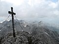
Summit cross

High glacier in the north flank

Braunarlspitze from the Hasenfluh, Madlochspitze in front of it on the left. Right next to the Braunarlspitze Kleinspitze and Butzenspitze, left behind Orgelspitze.


Web links
Literature / maps
- Freytag & Berndt: WKN364 Bregenzerwald . (Topographic map on a scale of 1: 50,000)
- Alpine club card : 3/2 Lechtal Alps, Arlberg area . (1: 25,000)
- Vorarlberg Atlas Vorarlberg Geographic Information System
Individual evidence
- ↑ Anton Spiehler: The Lechthaler Alps , in: The development of the Eastern Alps , Volume I, Verlag des DOeAV, Berlin 1893
- ↑ a b Dieter Seibert: Area guide Bregenzerwaldgebirge and Lechquellengebirge, 1st edition 1989, ISBN 3-7633-3328-2 , pp. 145 to 147
- ↑ PeakFinder Ltd: 360 ° mountain panorama from the Braunarlspitze. Retrieved April 15, 2020 .