Breitenbach (Siegen)
|
Breitenbach
City of Siegen
Coordinates: 50 ° 53 '26 " N , 8 ° 5' 38" E
|
|
|---|---|
| Height : | 364 (350-400) m |
| Residents : | 328 (Jun. 30, 2018) |
| Incorporation : | July 1, 1966 |
| Postal code : | 57074 |
| Area code : | 0271 |
|
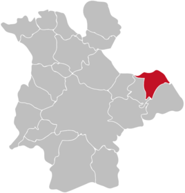
Location of Breitenbach in Siegen
|
|
Breitenbach is a district of the city of Siegen .
geography
Breitenbach is located about 5 km from the center of Siegen in the upper valley of the almost 4.6 km long Breitenbach stream of the same name , which flows into the Weiß in Kaan-Marienborn . Mountains around the place are, for example, the Breitenbacher Berg with 415.6 m height in the southwest or the Söhler with 490.1 m height, which at the same time forms the highest elevation in the area. The place itself is at an altitude of 350 to 400 m. The place borders in the southwest on Volnsberg , in the south on Feuersbach , in the east on Deuz and in the north on Netphen .
history
Breitenbach was first mentioned in a document in 1440. In 1770 a chapel school was built. Today the chapel serves as a place of worship for the evangelical parish Kaan-Marienborn. In 2001 the first wind power plant in the Siegen city area was built at the height north of the village.
Breitenbach belonged to the former office of Netphen and became a district of Siegen on July 1, 1966 as part of the local reorganization .
Population numbers
Population of the place:
|
|
|
|
Infrastructure
Breitenbach is on Kreisstraße 7, which leads from Kaan-Marienborn to Netphen. The next motorway entrance is Siegen, the next train station is also in Siegen. Breitenbach is dominated by agriculture, there is no industry in town.
Individual evidence
- ↑ Map of the Principality of Nassau-Siegen: Documentary evidence of settlement up to 1500 ( memento of the original from March 4, 2016 in the Internet Archive ) Info: The archive link was inserted automatically and has not yet been checked. Please check the original and archive link according to the instructions and then remove this notice.
- ^ Siegen-Breitenbach. muggelmaeuse.de, archived from the original on April 8, 2008 ; Retrieved September 5, 2014 .
- ↑ Stephanie Reekers: The regional development of the districts and communities of Westphalia 1817-1967 . Aschendorff, Münster Westfalen 1977, ISBN 3-402-05875-8 , p. 221 .
- ^ Otto Schaefer: The district of Siegen , Siegen 1968
- ↑ siegen.de: main resident population by district (updated regularly)
- ↑ Westfälisches Gemeindelexikon 1887, pp. 108/109
- ↑ Westfälisches Gemeindelexikon 1897, pp. 110/111
- ↑ gemeindeververzeichnis.de: District of Siegen
- ↑ genealogy.net: Office Netphen
- ↑ a b Michael Rademacher: German administrative history from the unification of the empire in 1871 to the reunification in 1990. City and district of Siegen. (Online material for the dissertation, Osnabrück 2006).
- ↑ Martin Bünermann, Heinz Köstering: The communities and districts after the municipal territorial reform in North Rhine-Westphalia . Deutscher Gemeindeverlag, Cologne 1975, ISBN 3-555-30092-X , p. 170 .
- ↑ Hartmut Eichenauer: Siegen ( Memento of the original from February 22, 2014 in the Internet Archive ) Info: The archive link was inserted automatically and has not yet been checked. Please check the original and archive link according to the instructions and then remove this notice. (PDF file; 11.67 MB) , approx. 1995

