Book (Siegen)
|
Book
City of Siegen
Coordinates: 50 ° 56 ′ 11 ″ N , 7 ° 59 ′ 0 ″ E
|
|
|---|---|
| Height : | 314 (290-360) m |
| Area : | 1.8 km² |
| Residents : | 765 (December 31, 2016) |
| Population density : | 425 inhabitants / km² |
| Incorporation : | July 1, 1966 |
| Incorporated into: | Hut Valley |
| Postal code : | 57078 |
| Area code : | 0271 |
|
Location of Buchen in Siegen
|
|
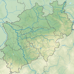
Location in North Rhine-Westphalia |
Buchen is a district of the city of Siegen .
geography
Buchen is located about 8 km northwest of the center of Siegen in the Sohlbachtal. The place is at an altitude between 290 and 360 m . Mountains in the area are for example the Holenborn with 404.8 m height in the southwest or the Dellenberg in the west.
The place is in the north of Siegen and borders among other things on the districts of Sohlbach in the east, Langenholdinghausen in the south and Meiswinkel in the west as well as Junkernhees in the north.
history
Buchen was first mentioned in a document in 1461.
On July 1, 1966, the municipality, which had been part of the Ferndorf office up to that point, was incorporated into the newly founded town of Hüttental by the first law to reorganize the district of Siegen . In the course of the new municipal reorganization, the city of Hüttental was incorporated into the city of Siegen on January 1, 1975, making Buchen a district of Siegen.
Population numbers
Population of the place:
|
|
|
|
Infrastructure
Beech is very agricultural, and industry is only represented in small forms. The place is on the district road 26, which leads from Geisweid to Junkernhees. Via Geisweid the place is connected to the Hüttentalstraße and the federal autobahn 45 .
Buchen had a soccer sports facility that had to be closed due to local complaints.
Web links
- Book (Siegen) in the Westphalia Culture Atlas
Individual evidence
- ↑ Map of the Principality of Nassau-Siegen: Documentary evidence of settlement up to 1500 ( memento of the original from March 4, 2016 in the Internet Archive ) Info: The archive link was inserted automatically and has not yet been checked. Please check the original and archive link according to the instructions and then remove this notice.
- ↑ Stephanie Reekers: The regional development of the districts and communities of Westphalia 1817-1967 . Aschendorff, Münster Westfalen 1977, ISBN 3-402-05875-8 , p. 222 .
- ^ Federal Statistical Office (ed.): Historical municipality directory for the Federal Republic of Germany. Name, border and key number changes in municipalities, counties and administrative districts from May 27, 1970 to December 31, 1982 . W. Kohlhammer, Stuttgart / Mainz 1983, ISBN 3-17-003263-1 , p. 336 .
- ^ Otto Schaefer: The district of Siegen , Siegen 1968
- ↑ siegen.de: main resident population by district (updated regularly)
- ↑ Westfälisches Gemeindelexikon 1887, pp. 108/109
- ↑ gemeindeververzeichnis.de: District of Siegen
- ↑ genealogy.net: Weidenau Office
- ↑ a b Michael Rademacher: German administrative history from the unification of the empire in 1871 to the reunification in 1990. City and district of Siegen. (Online material for the dissertation, Osnabrück 2006).
- ↑ Martin Bünermann, Heinz Köstering: The communities and districts after the municipal territorial reform in North Rhine-Westphalia . Deutscher Gemeindeverlag, Cologne 1975, ISBN 3-555-30092-X , p. 172 .
- ↑ Hartmut Eichenauer: Siegen ( Memento of the original from February 22, 2014 in the Internet Archive ) Info: The archive link was inserted automatically and has not yet been checked. Please check the original and archive link according to the instructions and then remove this notice. (PDF file; 11.7 MB) , approx. 1995
- ↑ http://www.soccercenter-siegen.de/


