Brombach (Mümling)
| Brombach | ||
|
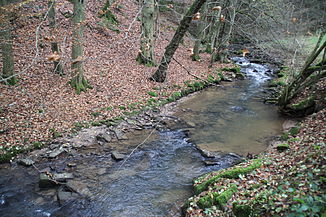
The Brombach near Zell in the Odenwald |
||
| Data | ||
| Water code | DE : 247456 | |
| location |
Hessian-Franconian mountainous region
|
|
| River system | Rhine | |
| Drain over | Mümling → Main → Rhine → North Sea | |
| source | on the eastern slope of the Spreng in the Hessian Odenwald 49 ° 42 ′ 31 ″ N , 8 ° 55 ′ 31 ″ E |
|
| Source height | 340 m above sea level NHN | |
| muzzle | near Zell im Odenwald in the Mümling coordinates: 49 ° 43 '26 " N , 8 ° 59' 38" E 49 ° 43 '26 " N , 8 ° 59' 38" E |
|
| Mouth height | approx. 182 m above sea level NHN | |
| Height difference | approx. 158 m | |
| Bottom slope | approx. 25 ‰ | |
| length | 6.3 km | |
| Catchment area | 11.85 km² | |
| Drain at the mouth |
MNQ MQ |
49 l / s 159 l / s |
The Brombach is a good six kilometers long left tributary of the Mümling in the Odenwald , in whose catchment area most of the districts of the municipality of Brombachtal are located.
geography
course
The Brombach rises with several source streams on the eastern slope of the Spreng , a convenient transition from the Mümling valley to the Gersprenz valley , which is used by the federal highway 47 , the Nibelungenstrasse .
From here the Brombach flows in an easterly direction through a wide, agriculturally used valley to Langenbrombach and receives the only noteworthy tributaries from the left, the Hembach , which comes from the town of the same name , and the Dorfbach , which flows through Kirchbrombach . Behind Langenbrombach the valley narrows between densely wooded valley slopes and the brook strives with a steep gradient towards the Mümling lowlands near Zell in the Odenwald .
The confluence with the Mümling is a few meters above the bridge of the Kreisstraße 91, which crosses the Mümlingtal to connect Zell to the Bundesstraße 45 .
Mümling river system
Web links
- Water profile and program of measures 247456.1 ( Memento from January 1, 2013 in the web archive archive.today ) ( Notes ) → Overview of all Hessian river systems (PDF, 1.7 MB) Brombach
Individual evidence
- ↑ a b Topographic map 1: 25,000
- ↑ Water map service of the Hessian Ministry for the Environment, Climate Protection, Agriculture and Consumer Protection ( information )
