Burweg (village)
Burweg is the eponymous district of the municipality Burweg in the Lower Saxony district of Stade . Burweg includes the Horst location , where the local church is located, and the Hohenlucht an der Oste residential area .
|
Burweg
community Burweg
|
||
|---|---|---|
| Coordinates: 53 ° 37 ′ 25 ″ N , 9 ° 16 ′ 12 ″ E | ||
| Incorporation : | July 1, 1972 | |
| Postal code : | 21709 | |
| Area code : | 04144 | |
|
Location of Burweg in Lower Saxony |
||
|
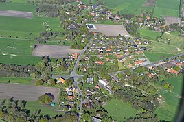
Aerial photo (2011)
|
||
geography
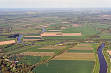
Burweg lies on the edge of the Geest in the marshland of the Oste. The Oste forms the border with the municipality of Hechthausen and the Horsterbeck the border with Himmelpforten in the northeast.
history
Burweg or Borchweghe can be traced back to Buurweg , the Bauernweg. It was first mentioned in a document in 1255, when Count Johann von Schauenburg and Holstein gave the Vo (i) gtei Horst to Friedrich von Haselthorpe (probably the older brother of Bishop Friedrich von Haseldorf ) .
In the First World War 18 soldiers from Burweg died, in the Second World War 17 soldiers.
Administrative history
During the French era , Burweg belonged to Mairie Burweg in the canton of Himmelpforten in the Kingdom of Westphalia , from 1811 to 1814 under Napoleon it belonged directly to the French Empire and there to Mairie Oldendorf in the canton of Himmelpforten.
Before 1885 Burweg belonged to the monastery district of Himmelpforten in the office of Himmelpforten , after 1885 to the district of Stade and since 1932 to the current district of Stade .
In the course of the regional reform , Burweg, Blumenthal and Bossel were merged on July 1, 1972 to form the current municipality of Burweg.
Population development
| year | Residents |
|---|---|
| 1791 | 60 fire places |
| 1824 | 71 fire places * |
| 1848 | 338 people, 72 houses |
| 1871 | 358 people, 68 houses |
| 1910 | 373 * |
| 1925 | 356 * |
| 1933 | 345 * |
| 1939 | 343 * |
* together with Horst
religion
Burweg is evangelical-Lutheran and forms its own parish with the St. Petrus Church on the Horst .
The deceased from Burweg are buried in the cemetery on the Horst.
Culture and sights
Buildings
- The Romanesque St. Petrus Church on the Horst was built in the course of the elder colonization by the immigrant Dutch, who were involved in the reclamation of the marshes, around 1200 from field stones with a medieval font. The old bell from this period was sold to the Lüneburg Museum in 1912.
- War memorial
- Several old hall houses
St. Petrus Church on the Horst
societies
- Volunteer firefighter
- Rifle Club (founded 1926)
- Heimat- und Kulturverein (founded in 2018)
- Sewage disposal cooperative
- Sports club Burweg
Economy and Infrastructure
traffic
The federal highway 73 runs through Burweg and leads in the northwest over the Ostebrücke Hechthausen via Hemmoor to Cuxhaven and in the southeast over Himmelpforten to Stade . In the south, the district road 66 leads via Bossel to Oldendorf ; In the north-west, the district road 81 leads via Breitenwisch to the state road 113.
The next motorway connection is in Stade on the motorway 26 (section Stade-Hamburg). Driveway 2 Stade-Süd is 18 km to the south-east.
The Niederelbebahn runs through the village ; However, there is no train station on site. The next train stations are in Himmelpforten and Hechthausen.
education
The students from Burweg attend the primary school in Oldendorf and secondary schools in Oldendorf (Oberschule) and Stade ( Vincent-Lübeck-Gymnasium ).
There is a kindergarten on site where the children are cared for five days a week in two groups.
Supply and disposal
Burweg used to be not connected to the local sewage system. Therefore, the sewage disposal cooperative was formed with the aim of centralizing sewage disposal via a protective water collecting point with a sewage treatment plant .
In order to be able to use the central wastewater disposal, the respective property owner must be a member of the cooperative, then he receives a connection to the central wastewater disposal.
literature
- Ann-Katrin Clauder: And back then it was Borchweghe - a chronicle of the development of the area between Oste, Horsterbeck and Bahnschienen. 2009
Individual evidence
- ^ Burweg, Stade district, Lower Saxony - online project fallen memorials. Retrieved September 7, 2019 .
- ↑ Christoph Barthold Scharf: Statistical-topographical collections for a more precise knowledge of all the provinces that make up the electorate Braunschweig-Lüneburg . Author, 1791 ( google.de [accessed on September 13, 2019]).
- ↑ CHCF Jansen: Statistical Handbook of the Kingdom of Hanover . In Commission of the Helwings̓chen Hofbuchhandlung, 1824 ( google.de [accessed on September 13, 2019]).
- ↑ Friedrich W. Harseim, C. Schlüter: Statistical Manual for the Kingdom of Hanover . Schlüter, 1848 ( google.de [accessed on September 13, 2019]).
- ↑ Prussia (Germany) Royal Statistical Bureau: The communities and manor districts of the Prussian state and their population: Based on the original materials of the general census of December 1, 1871 . Publishing house of the Royal Statistical Bureau, 1873 ( google.de [accessed on September 13, 2019]).
- ↑ Welcome to Gemeindeververzeichnis.de. Retrieved September 13, 2019 .
- ^ A b c German administrative history Province of Hanover, district of Stade. Retrieved September 13, 2019 .
- ↑ Welcome to kindergarten! Retrieved September 13, 2019 .


