Canhas
| Canhas | ||||||
|---|---|---|---|---|---|---|
|
||||||
| Basic data | ||||||
| Autonomous Region : | Madeira | |||||
| Concelho : | Ponta do Sol | |||||
| Coordinates : | 32 ° 42 ′ N , 17 ° 7 ′ W | |||||
| Residents: | 3769 (as of June 30, 2011) | |||||
| Surface: | 16.66 km² (as of January 1, 2010) | |||||
| Population density : | 226 inhabitants per km² | |||||
| Postal code : | 9360 | |||||
| politics | ||||||
| Mayor : | António Luís Romão da Vera Cruz ( PPD / PSD ) | |||||
| Address of the municipal administration: | Junta de Freguesia de Canhas Estrada da Igreja da Piedade, n.º 36 9360 Canhas |
|||||
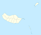
Canhas is a municipality ( freguesia ) in the district ( concelho ) of Ponta do Sol , on the Portuguese island of Madeira . 3769 inhabitants live in the municipality (as of June 30, 2011).
history
After the uninhabited island of Madeira was settled by the Portuguese from 1420 , the town of Ponta do Sol emerged from around 1425 . In 1501 the place became the seat of its own district. After a first village was established shortly afterwards in what is now Canhas, it was decided in 1577 to create a separate Canhas community by spinning off the community of Ponta do Sol, which was not implemented until a few years later. Canhas has since been a separate community in the Ponta do Sol district.
Attractions
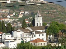
The single-aisled parish church Igreja Paroquial de Canhas , also Igreja de Nossa Senhora da Piedade (English: Church of Our Lady of Mercy) after its patron saint , is a listed building. The baroque church , built in 1756, shows inside a. a. Neo- Mannerist and Neo-Baroque azulejos and altarpieces made of polished wood. With the mannerist chapel Capela de Nossa Senhora dos Anjos (German Chapel of Our Lady of Angels ) originally built in 1508, there is another sacred building under monumental protection in the community. The Via Sacra was built in 1964.
Another architectural monument of the municipality is the Relógio da Água da Levada do Poiso water clock . The three-story building, erected at the end of the 19th century, widely indicated the intervals at which the allotted irrigation periods could be controlled by the farmers connected to the local irrigation canal Levada do Poiso .
Web links
- Canhas Township on the county website
Individual evidence
- ↑ a b www.ine.pt - indicator resident population by place of residence and sex; Decennial in the database of the Instituto Nacional de Estatística
- ↑ Overview of code assignments from Freguesias on epp.eurostat.ec.europa.eu
- ↑ History page ( Memento of the original from September 27, 2013 in the Internet Archive ) Info: The archive link was inserted automatically and has not yet been checked. Please check the original and archive link according to the instructions and then remove this notice. on the district website, accessed September 22, 2013
- ↑ History article on the Cahnhas community from the district archive , accessed on September 22, 2013
- ↑ www.monumentos.pt , accessed on September 22, 2013
- ↑ ditto
- ↑ ditto


